The day I . . .
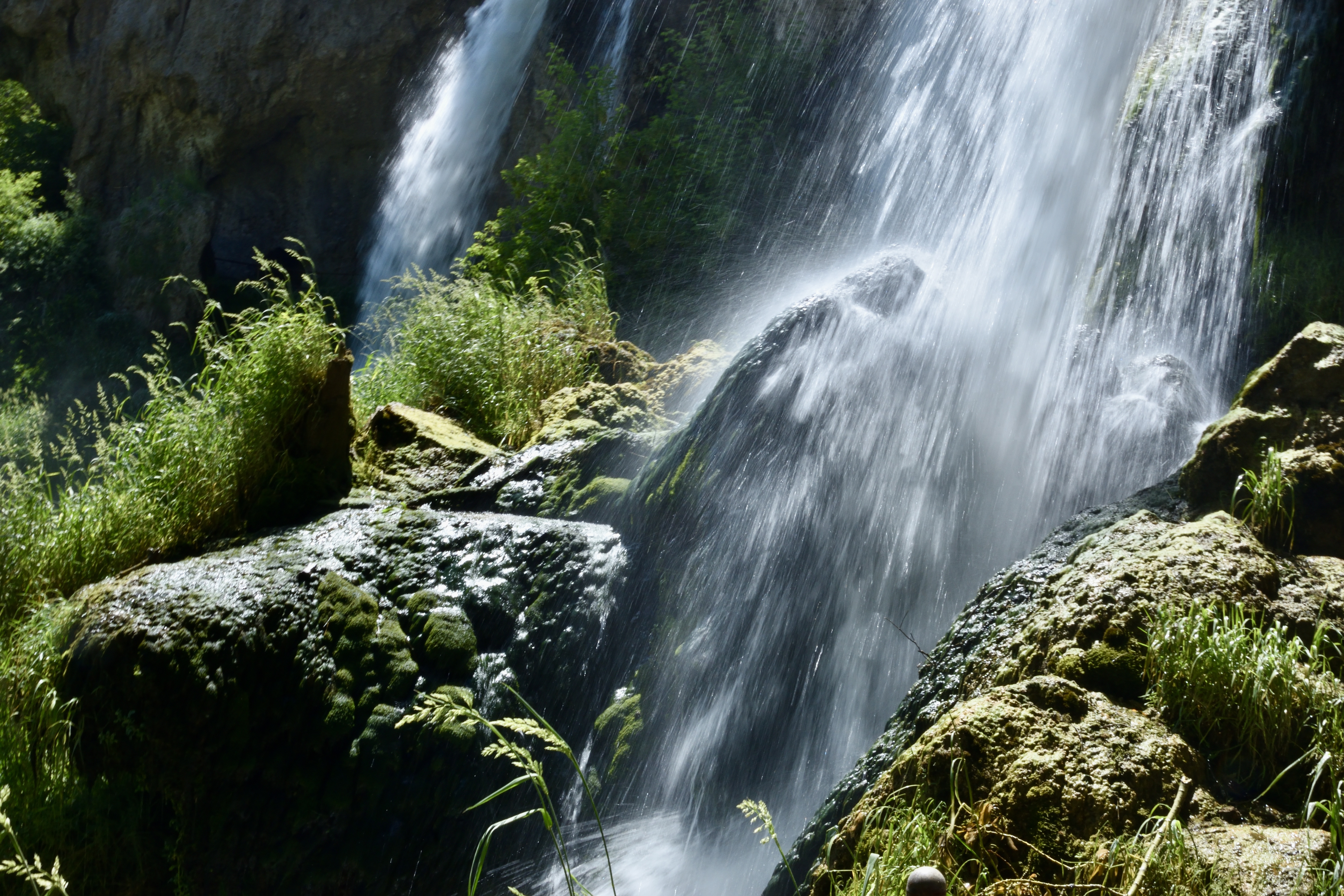
. . . locked the keys in the truck began serenely enough at our Holbrook, Arizona, motel with a nice breakfast and coffee. One night away to visit our son, Lewis, in nearby Joseph City: the three of us were off to McHood Reservoir, a lovely little lake that winds through a canyon of solid rock.


Fishing gear at the ready, we were encouraged by the large trout feeding on the surface. Our shadeless posts on stone perches quickly became uncomfortable; I decided I would change my clothing for better coverage, and it was all downhill from there.
I exchanged my wardrobe at the truck, dropped my discarded tank top onto the keys that were lying on the seat and, even with a hesitation about maybe leaving the truck unlocked because we were nearby, flicked the fateful switch, blithely unaware of my mistake until the señor requested his keys.
Fool-proof way to put a damper on activities, but there was better news: we were not at the end of a 15-mile unnamed dirt track in the middle of nowhere. A phone call later, and we were rescued by a fine gentleman from the not-very-far-away town, who encouraged me immensely with his cheery repeats: “No problem!” Easy for him to say, we were replenishing his wallet by my momentary brain-dead maneuver.

Historical irrigating . . .
. . . brought early pioneers to that seemingly barren wind-swept country when they diverted water from the Little Colorado River to grow crops needed to feed themselves and their livestock. That enterprise was indeed daunting in 1876 - incredible that they rebuilt numerous times when the structure washed away in floods.

With wills many of us can scarcely imagine, they constructed one diversion dam after another each time storms washed one out. After a good bit of research assisted by Chris, Lewis tracked down the dam's site and was anxious to share it with us.
We saw where the dam diverted river water to a large ditch engineered to deliver irrigation as needed near their settlement. . .
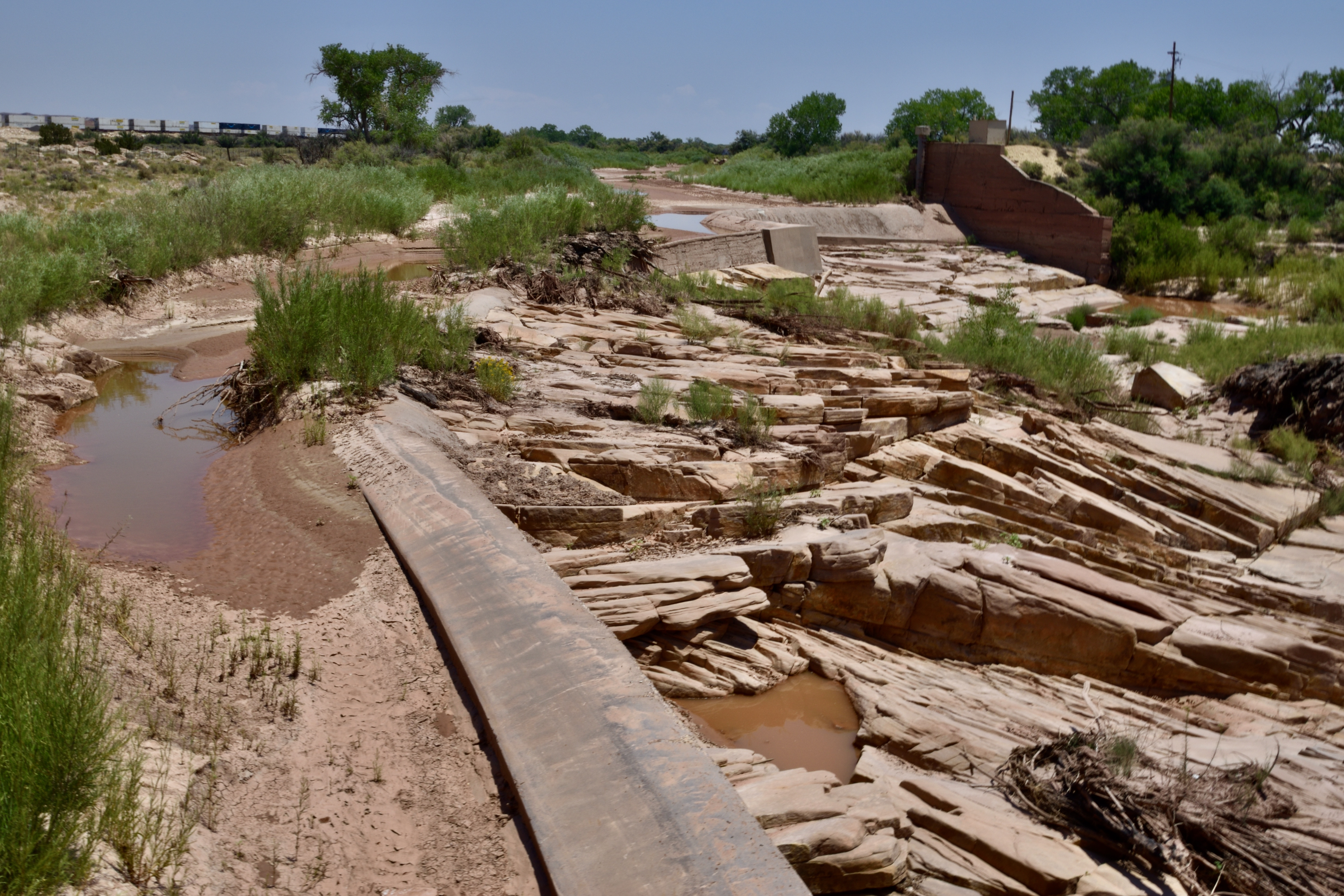
. . . and shortly after our visit, a storm brought the river to life, a scene that Lewis captured well to show how water is diverted into the ditch while the main stream flows by.
Here he’s checking out a mechanism that opens the gate to allow water into the ditch. . .

. . . and here they are . . . not really sure what they are doing.

Trailblazers . . .
In the larger scheme of things, much of Arizona, and the Southwest in general, remained unexplored long after most of the continent. Eventually explorers and pioneers in northern Arizona managed to find their way through harsh countryside, seeking viable passages and places to put down roots.
A plaque and bas relief I spotted in Winslow commemorated some of those route-finding & road-building ventures beginning in 1853. . .


. . . while other sites recall the region's history, in this case, the 1876 establishment of Joseph City, originally called Allen's Camp for Capt. William C. Allen, who led the small band of Mormon pioneers. It is the only remaining town of four originally settled by LDS members in that area; the others were Obed, Brigham City & Sunset.

Serendipities . . .
As we were dining at a local Mexican eatery in Holbrook, Lewis mentioned that across the street was a mural that tourists visited for photos.
We stopped by to see what the attraction was: the historic Route 66 was mapped on the building’s side, and photos were the name of the game.
It was there we saw a young couple with their youngster, and I offered to shoot a photo of the three of them. Realizing from their accents that they were foreign, I inquired about their origin: they were from Poland. We chatted a bit and went on our way.
Later, we were relaxing poolside at our motel where a young boy was splashing happily with his mask and snorkel. What a shock when we stood up to leave, walked around a corner and saw the same couple who were staying at “our” motel.
That serendipity loudly called for a follow-up; we sat and happily got acquainted with Marek, Karolina and their sweet son, whose name translates to Blaize (I think), the Polish version is lost to me.
How fun to meet that lovely family and to be able to stay in touch. They told us all about this trip (their second time in the U.S.) and their plans for touring the Southwest. They had already been to several Arizona sites, and Karolina was in love with our great state; she extolled at length about Arizona’s beauty and variety, clearly very astute.

Out ’n about . . .
Lewis appears to take after us with his love of gardening, as do both of his siblings. His peppers and tomatoes are thriving alongside his cute yard/patio.

It’s not unusual to see dust devils in the Southwest desert, but these may have been the granddaddies of them all.