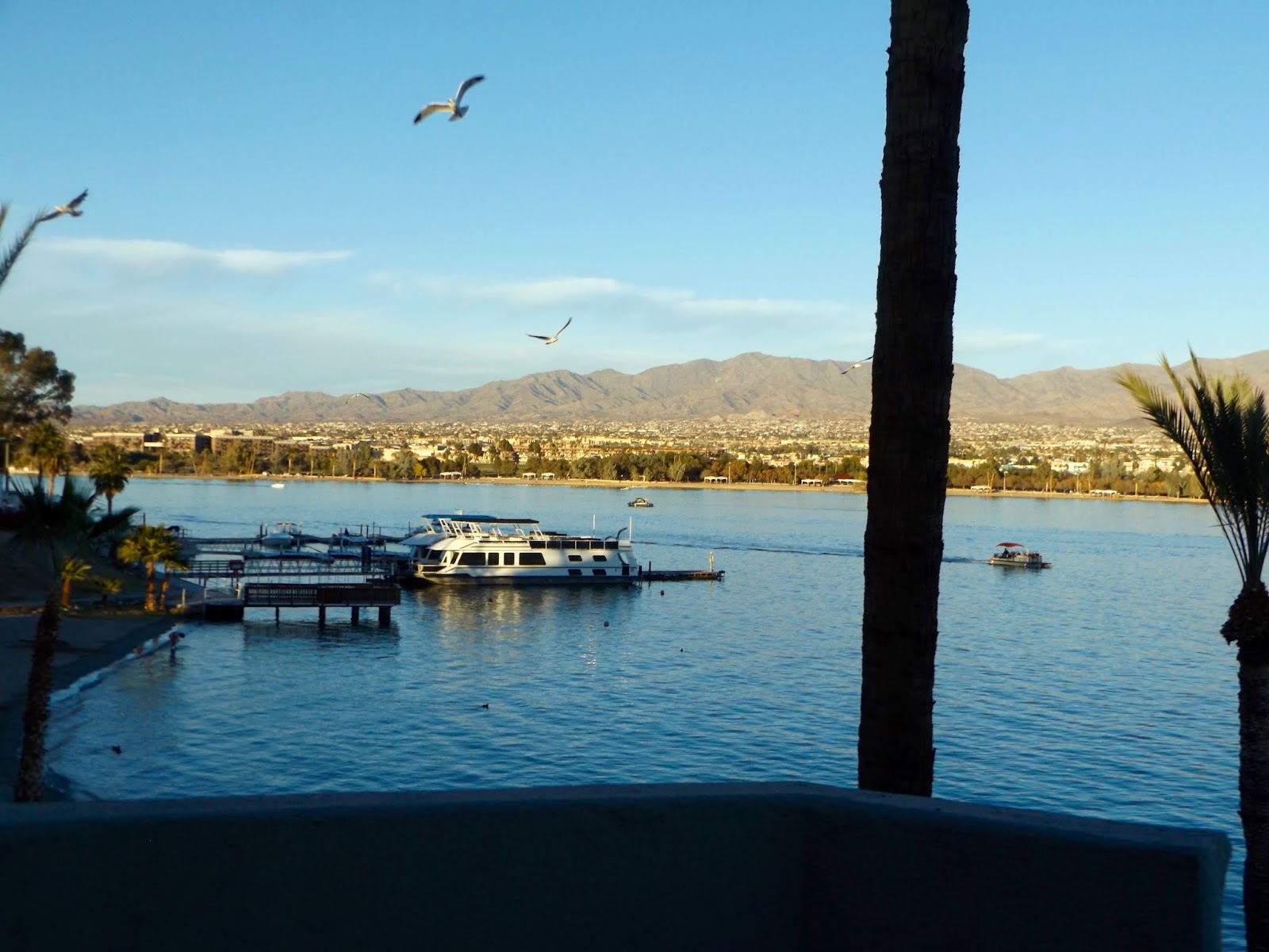
Monday, November 26, 2018

A plan
November 25, 2018


Whew!  We got there, and even more importantly, we returned!  The "there" was the wilderness area/wildlife refuge along the lake where Blankenship Valley meets the river.

As weariness dissipated (thankfully, it always does), we made plans for a full day.  We would rise early to take the boats out for some fishing.  Presuming we would tire of that at some juncture, we intended to take a trek into a wilderness area in Blankenship Valley.  That walk would take us to the national wildlife refuge that brackets much of Havasu’s shoreline.

As plans sometimes do, that one went awry pretty quickly after we discerned our weather situation.  Wind was whipping along at a good enough clip that the lake had whitecaps and the birds even grounded themselves.


We would have been blown to who-knows-where in our little kayaks, so the planned afternoon activity rose to the head of the line.

Equipment and clothing rearranged, we set off to that desert region north of the city.  The requisite road was a bit unclear; the map and the zig-zags made by off-roaders don’t necessarily match.  We tried one gravel road because the mountains in that direction looked interesting.  Not too far along, we felt a little bit of a sinking sensation, and I don't mean in our psyches; the Toter was perhaps not up to the task of navigation in sand-bottomed drainages.  After several attempts, a few turn-arounds and a good bit of discussion, we  decided that where we were was just right, despite the rooster-tails of dust were emanating from passing ATVs.

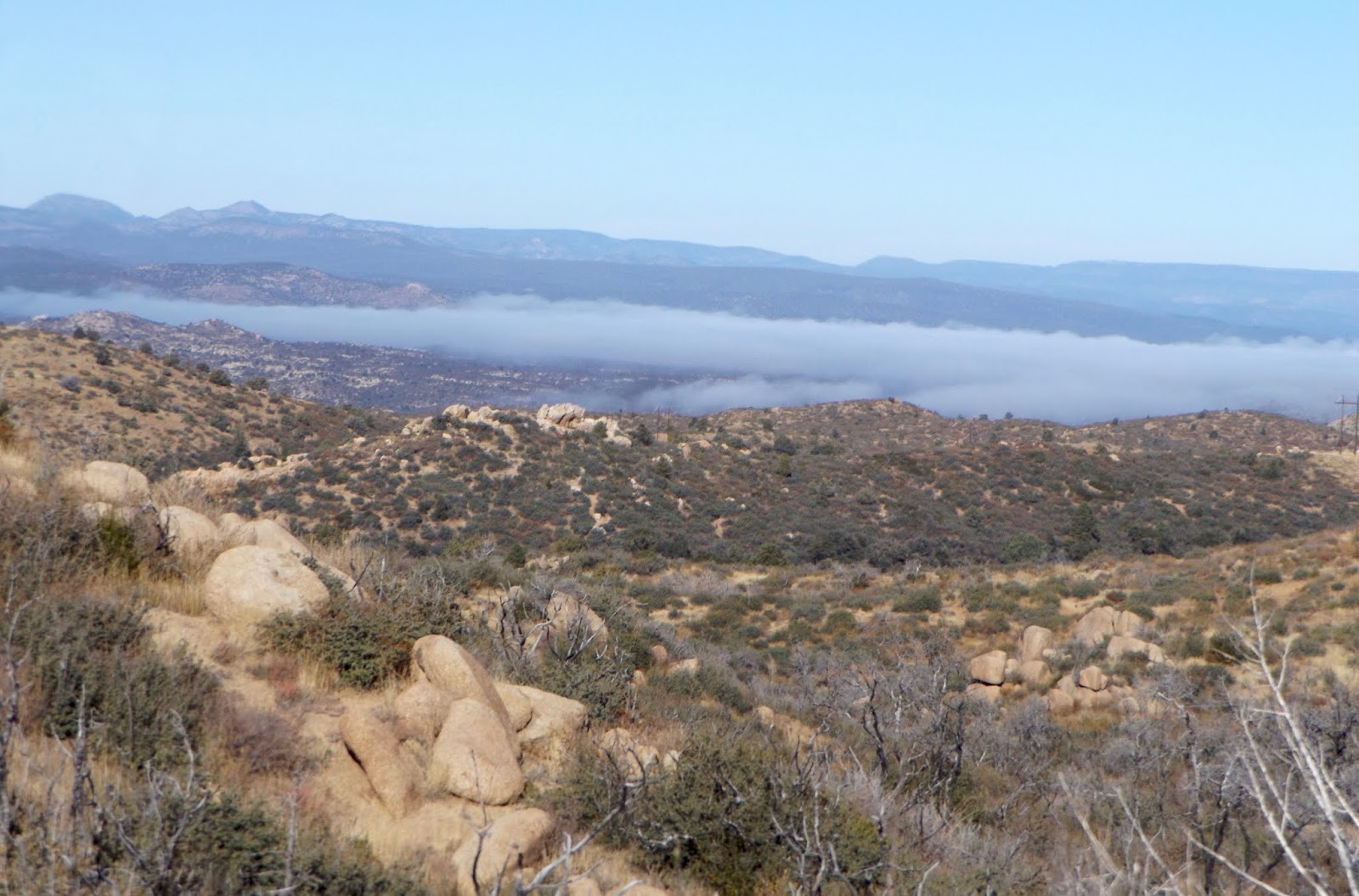
After all, we were heading into the Havasu Wilderness Area where they could not follow.  The designated motorized-free space encompasses 18,000 acres and is within the Havasu National Wildlife Refuge, which borders a good bit of the river.


Our walk downstream through the wide Blankenship Valley was hemmed on one side by one of the most gnarly rugged ranges ever, with beckoning twisted rocky canyons.


At times, our route was through water-cut narrows . . .


. . . and sand washes . . .


. . . but often just wandering through creosote-dotted gravelly flats and slopes, criss-crossed with burro tracks.


The occasional palo verde tree found a place amidst the creosote as in the photo below.  That picture shows the other side of the valley: an impressive line of sand dune mountains.


As we neared the valley's terminus, we could not see water, but knew it was near by the line of vegetation up ahead.  Skirting around high dunes, we headed for what looked like the nearest waterline,  Alas, we were met by an impenetrable jungle.

It was a heck of a long trek to get there and not get to water . . .


. . . so we followed a burro track up onto a high dune, presuming that if the animals went that way to get to water, so could we.  So much for that idea.  Our higher perspective did allow us to see a backwater marshy area (the lake along the river's course was still far distant), but it would have taken a machete, a chainsaw and waders to get us through that morass.


A bit more regrouping and wandering did allow us to locate a very nice lunch site with a view of the water that we were clearly never going to stand beside - darn good thing we hadn't planned to fish out there.

We caught sight of a beautiful northern harrier while we lunched and were surrounded by hordes of violet-green swallows.  We heard a phainopepla, which also got added to the list.


I am grateful that my wonky feet continue to do what I ask of them, but they and I pay a price for those demands.  By the time I reach the terminus of a long trek, I am feeling the pain, but obviously, there is no choice but to return, and so I do, and they continue to get me there despite it all.  

On the north side of the valley in front of that range of twisted leaning rock was a continuous high miles-long dune.  I really wanted to see what was at the foot of the mountains on the other side of it and I really didn't want to climb it; however, curiosity won out.  Up we went on the steep slope, only to discover that there was another line just like it, so our curiosity would have to remain unsatisfied.


Our higher vantage point did allow looks back at whence we came.  From down below, we were unable to see water anywhere at our approach, but this view was entirely different.  As we walked that high ridge, we often followed a burro track that made the way easier on the steep side slopes.  Even then, there were times when I balked at a traverse that was slippery enough to give my stomach flip-flops.  My modus operandi at those times is to refuse, balk, whine, whimper, refuse again, and then to give in to doing something I really don't want to do, but with the señor holding my hand for moral support, we get 'er done.  In that case, he cajoled that if the burros could do it, it must be perfectly safe.  I saw no bleached bones below; perhaps he was right.


As much sign as we saw that indicated the presence of burros, we were surprised not to encounter any.  That changed when we were up on the high ridge; I spotted a small herd of five burros across on the slope of the rocky range.  They were far too distant to get a photo, especially since the wind was blowing gale force.  It was work to remain upright - holding the camera still enough for that kind of shot was impossible.


We inspected what must have been a remnant from the granddaddy of all floods.  It appeared that water built up a large mud dike across a section of the wash and then washed most of it away.


When all was said and done, we were wind-blasted and tired and I was foot-sore, but we had had another adventure and seen a piece of country that was new to us.  Our eight-mile trek was done and we were grateful for our place in the world.

Sunday, November 25, 2018

A lack of urgency
November 24, 2018 

What is this feeling, this sense of relaxation, of "island time", as they like to call it here.  We awaken and care not for routine nor for anything needing to be done.

We crossed London Bridge - yes, the one from London, but more about that later - to reach our abode of five days on the island in Lake Havasu (In case you didn't read carefully there - it's Havasu, not Oahu).  Our first morning here was lovely really, sliding glass door open to the second floor deck as we wandered in and out with coffee cup in hand. 

A few early risers walked along the water's edge.  The noisome boats of yesterday evening were slumbering at anchor as a few fishermen motored slowly across the no-wake zone.

Other vacationers ventured out into the clement morning; youngsters always eager to meet the day gathered to play pretend lives just below us: Tonka trucks turned a sandy area into a construction zone.  Sidewalk chalk in hand, another adorned the walkway while a rousing game of cops & robbers went one direction and then another.  How reminiscent it seemed of times past when play was such sans electronic devices!

I welcomed the sounds of people chatting and laughing and watching their children.  The lure of water gathered us all there, its energy drawing us to itself.  I admire the palm trees, grateful that I no longer have one in my back yard as I remember the awfulness of trimming those bottom fronds with the dust and spiders and roaches and bugs falling onto me in the process.  How much nicer to look at these palms, nicely pruned by professionals and burgeoning with luscious dates.


From our deck, we watched the usual avian life: great-tailed grackle, California gull and western grebe.

Finally, we decide to depart our nest if for nothing else, we thought we might take a little drive around the island.  I don't know the island's size, but it is substantial.  There is a lot of development on it: condos, resorts, RV parks (they're all called resorts on the island), but a good bit of the land remains open.

Open in these parts seems to equate to ATV heaven.  We have seen the proliferation of ATV recreation in Utah and certainly it is abundant here, too.  I am decidedly not a fan of the vehicles; in fact, I fail to imagine the slightest attraction, but in that, I am a definite minority.

Everywhere hereabouts, one sees dust clouds rising - the incessant deafening sound of their engines is enough to drive a person to distraction.  I see that many of the riders wear protection for their hearing, but their lungs surely suffer seriously.  Their popularity is one of the reasons I prefer to do my wilderness sauntering away from established trails.


Relieved to be away from the dune buggies, we found some interesting places on the island, and some surprises - especially lighthouse replicas.  My languorous state causes me not to do the slightest research on the subject, but I did discover onsite that there are a number (how many?) of lighthouses along the shores of the island, evidently replicas of the larger items resident at waterside.

The one we stopped at was said to be one-third the size of its 1919 namesake, the Split Rock lighthouse on Lake Superior in Minnesota.  A plaque informed us that the Lake Havasu Lighthouse Club is dedicated to improving the navigational lighting on Lake Havasu.


Site #6 . . .

Ah lassitude, as I continue my day of directionlessness, I offer only this photo about Site #6, a place in history that had something or other to do with an early military camp and convalescent center for Army Air Force members in the 1940s.  


A vision. . .

Taking the words exactly as they are written on the Lake Havasu City website regarding the origin of a city that sprang from nothing along the banks of a newly created lake:

"Lake Havasu was formed by the construction of the Parker Dam from 1934-1938. ... In 1963, Robert McCulloch, owner of McCulloch Motors, was flying over Lake Havasu looking for a place to test his outboard engines. He thought that the land surrounding Lake Havasu had great potential for an emerging city."

And somehow (that I also will not research), that morphed into purchasing the 1831-era London Bridge, moving it from its England home and reconstructing it in the Arizona desert, then digging a man made channel under it to create the island.  If that's not a visionary and a getter-done-er, I don't know what is.  Anyone who has a few minutes of curiosity to fill can find some interesting reading online about the endeavor.

I thought it was fun to have a photo of London Bridge with palm trees aside it, something that would not have been anywhere near in its homeland.


Some years back when our Van Buren cousins lived in Lake Havasu City, we brought Mom & Dad Wuehrmann here to visit them and to see the bridge.  This trip, we made it a point to walk across London Bridge and to attempt to get a few photos despite multitudes of foreign visitors trying to do the same while walking and standing in front of us as we waited not-so-patiently for our opportunity.  In the end, I had to edit out someone's hairdo from my photo.


The afternoon was one of driving exploration along lake's shore with stops for treks up, down and around dune hills, bays, coves and marshes.  According to the señor, Lake Havasu's water level remains static, which allows the evolution of reedy, cattail-lined coves that shelter birds and, less obviously, lots of fish.


In various places as we traversed the shoreline with sandy beaches and dunes on one side and scattered vegetation on the other, we added to the trip bird list: yellow-rumped warbler, pied-billed grebe, Brewer's sparrow, blue-gray gnat catcher and roadrunner.

Castle rock was one place that especially intrigued us as a spot to launch the kayaks for some fishing.


We were also intrigued by a vast area of badlands we spotted on the California side of the water . . .


Another side road detour area looked promising for a future back-country trek into some interesting mountains.


A tourist mecca, Lake Havasu offers recreation for all imaginable water sports and fishing, not to mention all kinds of fun overhead.  There is a steady stream of tour planes, ultralights and experimental aircraft . . .


 . . . even the Goodyear blimp.  I haven't seen the Goodyear blimp in years; actually I didn't even know it still existed. 

Friday, November 23, 2018

Across the desert to water
November 23, 2018

A journey - what fun to anticipate whatever adventures will be found along the way!  We are on the way to Havasu City to spend a few days at a timeshare trade and see the world from a different perspective.

As we traversed the twists and turns of Iron Springs Road leaving Prescott, we had to pull over for a quick shot of the heavy mist blanketing the valley below.


Planning to keep a bird list this trip, we began with several ravens perched artistically among the bare branches of a large leafless tree.  Next up on the list was a red-tailed hawk followed by a great blue heron flying overhead, not exactly what would be expected, but then that’s the fun of seeing what is to be seen.

Although our return drive will necessarily be via the interstate because of commitments, we anticipate a leisurely drive over to our destination.  No trailer tagging along behind, but we are using the Tundra instead of Ruby the Four Runner because we have the kayaks riding atop.  We are, after all, heading to water with fishing gear on board.

The gentle winter sun is bathing the landscape with soft golden hues; in Skull Valley Wash, the cottonwoods reach high, shimmering with stunning gilded leaves.  Ferguson, Peeples and Skull valleys comprise perhaps my favorite area of Arizona, although I tend to feel fond of whatever region in which I find myself.  It fills my heart to look out over the landscape and wonder what secrets it holds.

Yarnell Hill, Hotshot memorial . . .

Going through the tiny burg of Yarnell, we notice there’s a place set aside for the shuttle to the Granite Mountain Hotshot memorial trail head, but halfway down Yarnell Hill, it is obvious that many folks prefer using their own vehicles; the trail head parking lot is full and cars are pulled off to the side of the road for a ways.

It gets me to wondering how many generations will pass before we collectively forget about the Granite Mountain Hotshot tragedy.  It’s still raw and fresh in our consciousness, but what started me on that conjecture was a memorial we saw last summer in Wyoming’s Bighorn Mountains.

That structure commemorated the deadly consequences of Wyoming’s 1937 Blackwater Fire which killed 15 very young men and badly burned 38 more, many of them CCC volunteers from Texas.  A horrifying occurrence, like others, but mostly unremarked now beyond the few who were somehow associated with it.  Society’s memory seems to be fickle and selective indeed.

Now I’ve turned a somber note, especially noticing the layer of smoke spread across the desert below Yarnell Hill, surely reaching across from the devastating California fires.  Wondering if it will be smoky at Havasu. . .

Bouse, the Colorado . . .

As we began to wonder about the next restroom location, we were trundling through the wide-spot-in-the-road called Bouse and did a quick turnaround to lunch at the Coachman’s Restaurant.  Fortuitous - the owner was an ebullient Sicilian who kept us entertained through our meal.  At the next table, we met a very nice couple snowbirding from Craig, Colorado.  That location’s far-below-zero winter clime keeps them returning to the Arizona desert.  We had fun recalling with them what we remembered about their wonderful home region which we visited two years ago and which we vowed to return to.  Turns out they also were near Casper, Wyoming, at the same time as us to experience the total solar eclipse of 2017, and they were as awed by the experience as we were.  We all got goose bumps as we talked about the experience while sharing our stories.

No matter how many stops we make along the way, we eventually reach our destination.  As we drove through Parker and crossed the Colorado River on the bridge, it felt nicely familiar after having RVed there several times.

We turned northward after the crossing, keeping to the California shore because it is less developed and sometimes has marshy backwaters that have ample bird life.  This time, we found ponds that were not as full as in the past, but that had sufficient water and cover to encourage birds to congregate.

One channel that we walked along is so choked with reeds that there is very little opportunity to get to the water.  When we did, we saw American coot, double-crested cormorant, white pelican, black phoebe, ruby-crowned kinglet and mallard.


One of the great egrets there attempted to secrete himself from our view, not hard to accomplish with the thick brush cover.


A larger pool was not as crowded as we've seen it in previous years, but we enjoyed watching a large flock of white-faced ibises and snowy egrets milling around in the far-side vegetation at water's edge, too distant to hope for a photo.


Burros, Parker Dam . . .
The narrow highway follows the river's meanders, leaving little opportunity to get a photograph of wild burros that wander wherever suits them.  I do enjoy seeing them, though.

Before we crossed back to the Arizona side on Parker Dam, we stopped once again to see what waterfowl were gathered there.  Using the spotting scope, we identified ruddy duck, ring-necked duck, redhead, lesser scaup, bufflehead, common merganser and a flock of pigeons circling overhead.

While getting a shot of the dam, I took a selfie of sorts.


Lake Havasu . . .

Late afternoon brought us to our lodging on Lake Havasu's island.  Incredible in my mind is looking across the water to Lake Havasu City, a metropolis of 56,000 people that didn't even exist when I was young.  Developed in the 60s, it has grown rapidly into a thriving city.  It puts me in mind of a place closer to home - Prescott Valley - which also didn't exist during my youth.

What a nice view we have right at the shore across to the city!