
June 8, 2020
The big reveal . . .
This is it, people: Chris' & my latest venture - online video Edventures tours through Yavapai College. Two of them are now available at https://www.campusce.net/yc/course/course.aspx?C=10699&pc=30&mc=&sc=,
and https://www.campusce.net/yc/course/course.aspx?C=10700&pc=30&mc=&sc=, and the third will soon follow. Who knows where we might journey next, but wherever it turns out to be, we hope that you will enjoy following us "live". as well as through my blog offerings.
Duff Springs . . .
. . . a hiking destination that we have enjoyed quite a number of times: sometimes for fishing in the Verde River, others for seeing the prehistoric and historic sites and artifacts, for guiding Yavapai College Edventures groups or to share the wild canyon and river with friends.
Of course I can scarce stand to head down canyon without first snapping shots of our majestic snow-capped San Francisco Peaks rising above Sycamore Canyon's alluring morning-misted cliffs.

Our maiden voyage of filming Chris teaching about the environment was quite a gigantic learning curve. Perhaps the equipment was not of highest quality to start, but despite some stumbling and bumbling and figuring it out, in the end, we produced a 90-minute-or-so video that is chock-full of interesting information, courtesy of the señor who freely shared his breadth of knowledge.
In addition to the hike into Duff Springs on the Verde River, there are segments about the now non-existent town of Jerome Junction on the eastern boundary of Chino Valley and how the narrow gauge railroad connected to the main line there.
And then there's the history of the spring's namesake, Alexander Duff, and his tenure at Jerome Junction and so much more. I have blogged about much of that previously, so for this post, I will stick with our film making trek partially along the nearly obliterated wagon road to Duff's homestead. His history is quite interesting and we were amazed to discover that his 1896 house in what is now Chino Valley not only stands today, but is well-maintained and occupied.

Always for me, the vastness of Arizona's varied landscapes is as fascinating as the smaller, sometimes unnoticed sights underfoot. I am awed be the miracle of plants flowering away as if they were in a tended garden but are actually maintaining some kind of foothold in a bed of rocks.


I admit that I was a bit "off" physically that day. The hike felt more strenuous than previously; going downhill was just fine but climbing out was wearing. How fortunate that those who watch the video need not be concerned about being physically taxed!
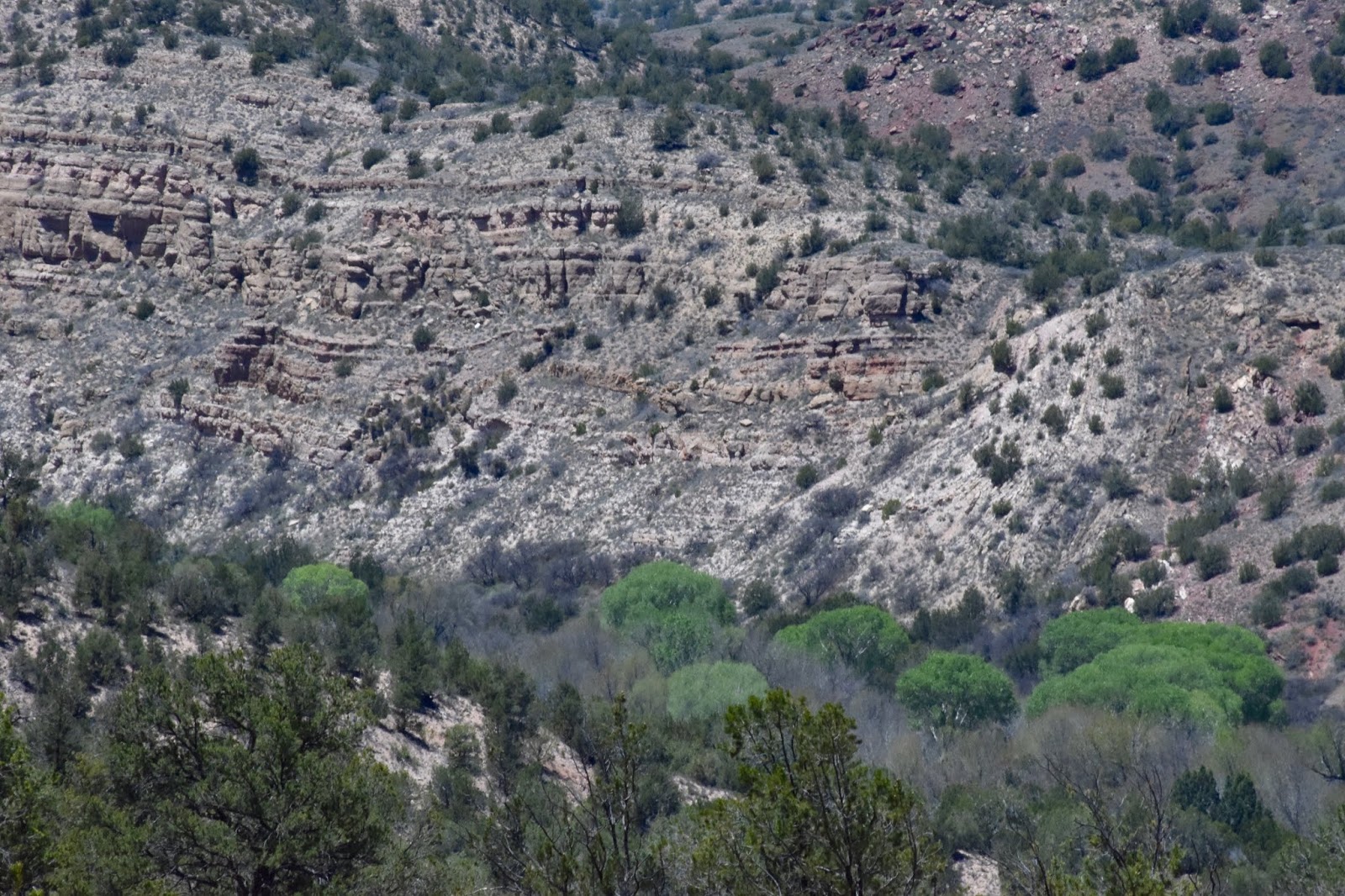
There's our first glimpse that foretells the presence of water in the canyon bottom: those green crowns below are cottonwoods along the river's banks.
As we enjoyed the vast mountain and canyon scenes and noted the smaller details around us, we were treated to overhead sights, as well. At one point, two turkey vultures soared above us along with a pair of red-tailed hawks, seemingly unusual playmates.

Both of us are fascinated with geologic features. One of us has explanations for things such as the right-angle rock layer shown below, and in the video, he teaches about that, as well.

In addition to small flowering plants tucked here and there, we noticed larger shrubby vegetation like Arizona or desert Christmas cactus, also called tsejo, as well as other names: only one of many things that were utilized by the native people who lived there.

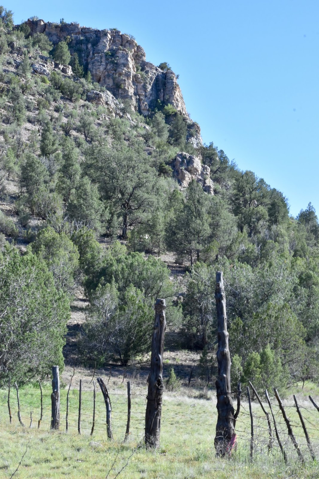
Looking upward from the canyon bottom, the cliff buttresses are beautiful in their massiveness.

Once again reaching the well-watered area around the spring, we bushwhacked our way through tangles of brush, tree branches oranged with lichen, stiff remains of striplings that slapped at us as we pushed through them, and soft green grass patches on soggy soil to get to the glass-clear and duck-weed-covered water bubbling up out of the ground from under a tree stump on its way to the nearby river.


Upstream from the spring and just across the Verde up high on the cliff face are the remains of a prehistoric cliff dwelling. The ruins are fragile; we photograph them from below, but don't disturb them in any way.

Alexander Duff headquartered his ranch at the confluence of the spring and the Verde River about 1880 prior to his tenure at Jerome Junction. He and his wife worked there to wrest a life from the earth. In common with many a western ranch family, they probably grew some crops and a subsistence garden and ran cattle on the sparse range. There is evidence of rock structures, possibly their cabin and the rubbley ruined dwellings of prehistoric people who would have also valued the available water.
I wrote about the Duff family in a post earlier this year, so will not belabor their history here. Suffice it to say that there is a tragic element involved when Alexander's wife, Margaret, suffered some sort of mental breakdown. She died during her institutionalization, leaving behind four children, at least two of whom were likely born at that homestead site. With his second wife, a teacher named Ella, Duff had two more children during his years at Jerome Junction.
The Verde runs tranquilly through much of that section of the canyon, serving as a lovely resting spot before our trek back out.

The route upward is not especially steep, but it is long enough to feel like it. As we climbed, we once again enjoyed the wonderful scenes that were continually revealed. That being our first foray into the educational video tour arena, we worked at learning when and how to zoom, how to frame a shot and remembering to turn on the sound (pretty important, as it turns out). Our efforts were hampered by very little camera battery life and a small chip onto which record Chris' teachings. In addition, we had only the camera microphone which proved inadequate in the presence of windy conditions.
In yet another learning curve, Chris taught himself how to edit the movie and used extensive voice-overs for some scenes, in the end producing an interesting and educational video. Not quite like being there in person, but then the added benefit is you get to watch it from the comfort of your home and eliminate that long hike.

The following photo shows the route of the defunct narrow gauge railroad as it makes its way from the site of Jerome Junction through the notch cut in the ridgeline and over the mountain to Jerome. It is a scenic route that can be driven by vehicle; the tracks were long ago taken up, and Chris teaches some about that, too.

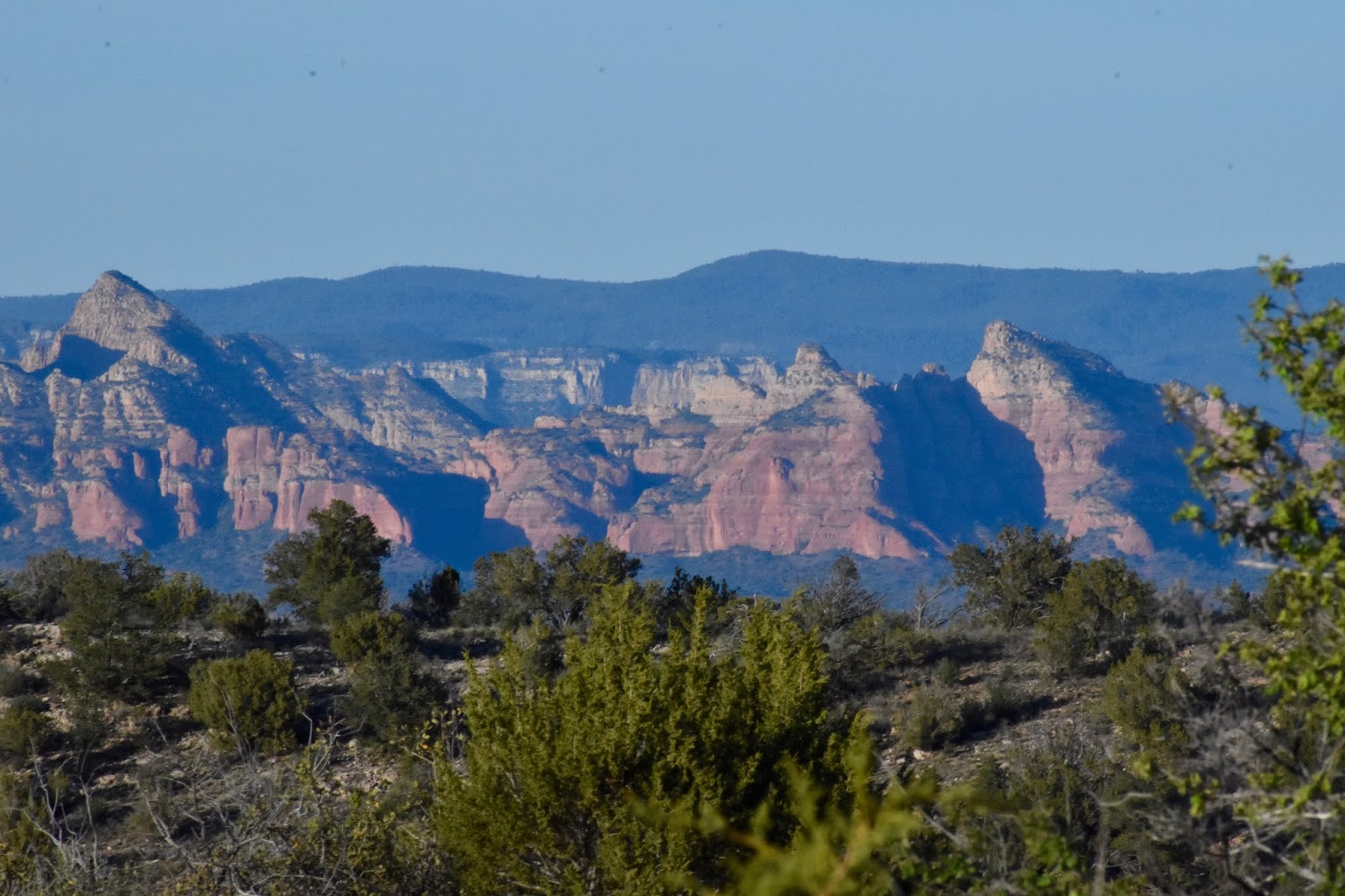
An afternoon view of the Sycamore Wilderness area is entirely different when the late light is on it.
We made it up and out, back to the piñon/juniper country above the canyons carved by rushing waters and back towards Chino Valley where we stopped for a photograph of the entrance to the Garchen Buddhist Institute. It is a lovely and peaceful place to visit, but is closed right now because of the Corona virus pandemic.


Johnson Canyon and so much more . . .
Heading north for our second stab at producing a YC Edventures video, we stopped in Chino Valley for a photo op at Chino Rentals, where the guardian gorilla is equipped with virus safety precautions.

When one sets out to embark on a new and uncharted journey, one typically conjures some measure of mindset about what to expect, and our adventure with YC online Edventures was no exception. Of course Chris had mentally devised a coherent educational tour. After all, he has decades of experience in sharing his knowledge to groups who enroll for his trips.
I, on the other hand, had no experience with videotaping, but between us, we quickly learned the hows and whys of transforming an entire day of travel, trek and talk into filmed programs that can be enjoyed online.
My mindset in the beginning somehow saw the process as similar to our much-enjoyed random wanders around Arizona or wherever else we find ourselves. The reality turned out to be a good bit more work and less fun, although for the viewer, it will be the opposite - no work and more fun.
In the first place, everything takes so much more time than when we're just playing. Drive to a destination, get out the equipment and carry it to where we have decided to set up. Get it ready and discuss how to do the scene, do the filming and trek back to the vehicle to do it all over again somewhere else multiple times in the day. It is downright exhausting; good thing we feel good about being able to share these adventures with lots more people, and especially that we can do it through the pandemic when folks are otherwise confined.
Before setting off on the Johnson Canyon segment of our Edventure, we spent significant time discussing where the filming would take place and what other features of interest would be included, like sinkholes and craters and such.
One very odd thing occurred the day before we were scheduled to do the job. In case anyone hasn't noticed by now, we are rabid genealogists and researchers. We were working on charting some information from a book written long ago by a family friend when we discovered that a person we were including in our charts had been married to a shirt-tail kin and long ago friend of mine, and that she was also the great granddaughter of George Johnson, for whom the Johnson Canyon is named. The chances of that kind of coincidence must be astronomical, but there it was.
As I mentioned, these sessions take ever so much longer than we think they will. We have now completed three of them and all required a second day to get 'er done.
It never seems to fail that when we are out and about wandering back country, we run across things unforeseen and unexpected. Our Johnson Canyon Edventure included segments about features in the area, including McClellan Reservoir on Johnson Creek, dammed by the the Santa Fe Railroad as a water catchment for steam engine use and for the growing railroad town of Ash Fork and its Harvey House on the Santa Fe line.
Along the way, we called a halt to film an introduction to what lay in store for the day, and were rewarded with the loveliest little stream flowing softly through its grass-lined, wild-iris-dotted bed.


Chris' research mapped out the route to get to the reservoir, but when all is said and done, dirt roads in the back country are not exactly as they appear on topographic maps, so it's a bit of a by-guess-and-by-golly kind of drive along rough roads. In this case, we were right on target wending our way along this fork and that fork. Finding the correct roads worked just fine in this case, that is until we found the way blocked by large equipment that was setting up a cell tower, the kind that is not so cleverly disguised as a pine tree.
Well, we are not ones to pass up an opportunity, so we simply stopped where we were (as if we had a choice) and did a bit of filming on the spot. After all, it was an interesting insert to the day. As you can see in the photo below, everyone ran for cover when the crane swung that huge pipe around to be placed on its foundation.


These are the "limbs" of the tree waiting to be attached.

Because the workmen had the road blocked, we continued on the short distance afoot to get to the lake. It appears that a return for fishing is in order . . .

Traveling through various elevations and zones has allowed us the joy of seeing many different flowering plants and cacti. This one was totally loaded, almost more bloom than cactus.

In tracing the history of how the railroad impacted that part of the country, we hiked into Stone Dam, another reservoir built by Santa Fe and learned more fascinating history . . .

. . . and Steel Dam, where the señor taught about that unique structure, one of only three in the world to be constructed in that way.


Rather oddly in my opinion, Steel Dam was faced with multiple sheets of corrugated tin, most of which are now somewhere downstream in crumpled masses. Historic photos of the dam and more information are included in the virtual tour.


When the railroad surveyors and engineers were working to devise a route off the steep Coconino Plateau, they had to overcome many rugged physical obstacles; the way they chose traversed a portion of George Johnson's ranch, thus the canyon was named for him. In addition, the route was so steep and difficult that it necessitated construction of the only railroad tunnel between Albuquerque and Los Angeles.
In our Edventure, Chris shares lots of fascinating information and I manage to record all of it this time - not one instance of forgetting to turn on the sound - yay! And the lapel mike gave us a much better sound quality without the wind noise interference.
As we searched for the Johnson Canyon Tunnel work camp, we encountered some very washed out rough roads that kept our progress to a crawl. At one point, Chris missed a rock in the road, so I made sure that he backed up and had another go at it.
When the tunnel was being constructed in the early 1880s, a substantial work camp was established on the plateau above the railroad bed; workmen climbed down from there via a cleft in the steep cliff to work on the monumental structure.

One of our goals was to find the site of that camp. Although it consisted of more than 3,000 men for a bit over a year, there is nearly no indication today that it even existed. It would be very simple to pass by and never notice anything. Closer inspection reveals a wide scattering of bits of broken glass and rusting metal cans.

George Johnson was an interesting Englishman who may have played a role in the security for the royal family there, at least according to family lore. He immigrated to the United States in 1857 in his early 20s.
He quickly enlisted in the U.S. Cavalry and served at Camp Lowell near Tucson. Accompanied by his English wife, Elizabeth, he completed a 15-year stint with the army at Camp McDermitt in Nevada. Upon his discharge, George and Elizabeth and their five surviving children traveled to northern Arizona with their herd of 2,000 sheep. What a feat that must have been, especially with having to ford rivers! At one point, a ferryman jerry-rigged a ferry consisting of a number of boats tied together to get the sheep across a raging torrent.
Their initial choice for a winter spot was wholly unsatisfactory because of deep snow, so the family established their ranch at the location we went to, northwest of Williams. It's delightful country visually, but incredibly rocky with volcanic debris. One little stretch of road smoothed out just as we approached Headquarters Tank, which turned out to be lake-size and picturesque, to boot, not at all the small muddy pond we expected.


Another example of things seen unexpectedly along the way: a lone grave marker for a 14-month-old boy up top on a wide grassy plain next to a two-track across the open area. Little Edward Cooney, son of J.C. & M.E. Cooney was laid to rest there in the summer of 1882.
I don't know anything about the circumstances of Edward's death nor what his parents were doing there, although I could hazard a guess that it had something to do with the construction of the Johnson Tunnel. Perhaps some workmen's families were present and helping with meal preparations.
I am surprised that such a substantial marker has been placed there in such isolation, and gratified that it has been so well protected by fencing that prevents damage from livestock.


There is always beauty along the way . . .


When we decided to shoot a self-portrait at the edge of the plateau, I had 20 seconds from clicking the shutter button to find my perch on a rough-edged lava rock. Below is the result as I missed my mark and fell backwards. Luckily, I did not knock Chris over in the process. Next shot worked out better.

Our long day got even longer when we made our way to the railroad bed itself down below. We had been there previously, and so were aware that a section of the route has washed away and we would have to hike to the tunnel. What we did not know was that Forest Service personnel have blocked the trail much farther back in order to have a turn-around place for vehicles. Argh! That increased our late-day hike with equipment quite a bit longer, but hey . . . anything for good ol' Yavapai College.
At least it's a relatively level trail and certainly the canyon and vistas are really stunning.


And there it is: the Johnson Canyon Tunnel. I suggest watching the virtual Edventures tour to get the full story of it and so much more from the señor.


A return for a second day of filming necessitated yet another traverse of Johnson Canyon, a rough and rugged 4-wheel-drive climb down in and back up the other side, slowly crawling really. We make it through places like that because: 1. Our Toyota 4-Runner is an amazing workhorse, and 2. I hang on tight to the handle that is well-placed inside the car and completely tense my entire body while holding my breath. What can I say - it works.
How fun that we encountered not one, but two herds of sheep at pasture, and how appropriate since we had been researching about George Johnson and his sheep ranch. This blog post seems to be jumping all over the place, so why don't I just take the time now to write a bit more of what we learned about him. I think I have mentioned something about his family, but his demise is what got my attention.
When George became very ill, Elizabeth was left with no choice but to load him into the horse-drawn wagon, leave the children at home and take him to the nearest place to seek medical help, which was Prescott. I have just said something about crossing Johnson Canyon in our motor car; how that journey would be in a wagon is beyond my ken. I don't know how long it took her to get to Prescott, but I would guess the best part of a week, at least. Oh, and did I mention that she was pregnant at the time?
In her worry, she would have packed provisions for the trip, camped along the way, hitched and unhitched and tended to the horses, all the while caring for George and worrying about her children who were left to fend for themselves. The mind cannot comprehend how difficult that life was and how harrowing that trip.
Evidently, George survived the journey, but died in the hospital in Prescott, leaving his pregnant widow to embark on the return trip on her own - a tragic and sad story, but certainly not an isolated one for those who pioneered this country.
Back to the sheep . . . under normal circumstances, I would have sought out the shepherds who were moving their herds for a little chat. In this case, I did not because we were working on the YC tour; however, it gave us the opportunity to include an interesting talk about northern Arizona's sheep herds, historically and currently.


Notice the sheep dog in the midst of the herd as he carefully keeps an eye on us.


We wrapped it up at an abandoned Highway 89 bridge over Johnson Creek just above where it ceases to exist as it runs into Ash Creek, many miles downstream from where we began.


Northern Bradshaws . . .
Today, the northern Bradshaw Mountains are alive with humanity - hiking, biking, ATVing, exploring and fishing. Nearly 150 years ago, though, the activities were very different, but even then, the mountains were being explored, but mostly for gold and other valuable minerals.
So much has transpired in the intervening years, and Chris has put together a fascinating guided video Edventure all about it. In it, there is a surprise shot of the bridge in the photograph below when that was the new 1913 Senator Road.

We began our tour right there in Groom Creek . . .


. . . and proceeded further into the mountains, discussing the flora and fauna, the homesteaders and prospectors.

At one abandoned homestead, we saw an old apple orchard that has long outlived those who so optimistically planted it. The woodpeckers seem to have a great appreciation for some of the trees . . .

. . . that are still producing fruit.

River birches shade the little creek there . . .

. . . and blackberries cover the slopes . . .

We heard about the mine at that homestead, and moved on to the site of another of the many mines and mill sites throughout the Bradshaws - the Senator Mine and mill. As we pulled up to climb down to the old mill's remaining framework, a couple of surveyors arrived at the same time and informed us that the "X" they had laid out on the ground was to assist aerial photography. According to those fellers, the Senator Mine is to be reopened.

It makes me a little queasy to peer over the edge far down into the canyon from the mill's iron skeleton . . .

. . . maybe not so much for the many artists who have visited.

These are some of the extensive tailings from previous working at the Senator.

There are many diverse plant communities among the varying elevations and micro-climates of canyons, mountain peaks, creek bottoms and sheltered alcoves; the varieties seem endless.


I am amazed at how many mountain streams we encountered: Crook's Canyon, Wolf Creek (two of 'em), Turkey Creek, the Hassayampa River, plus nameless seeps and springs and Hassayampa Lake.


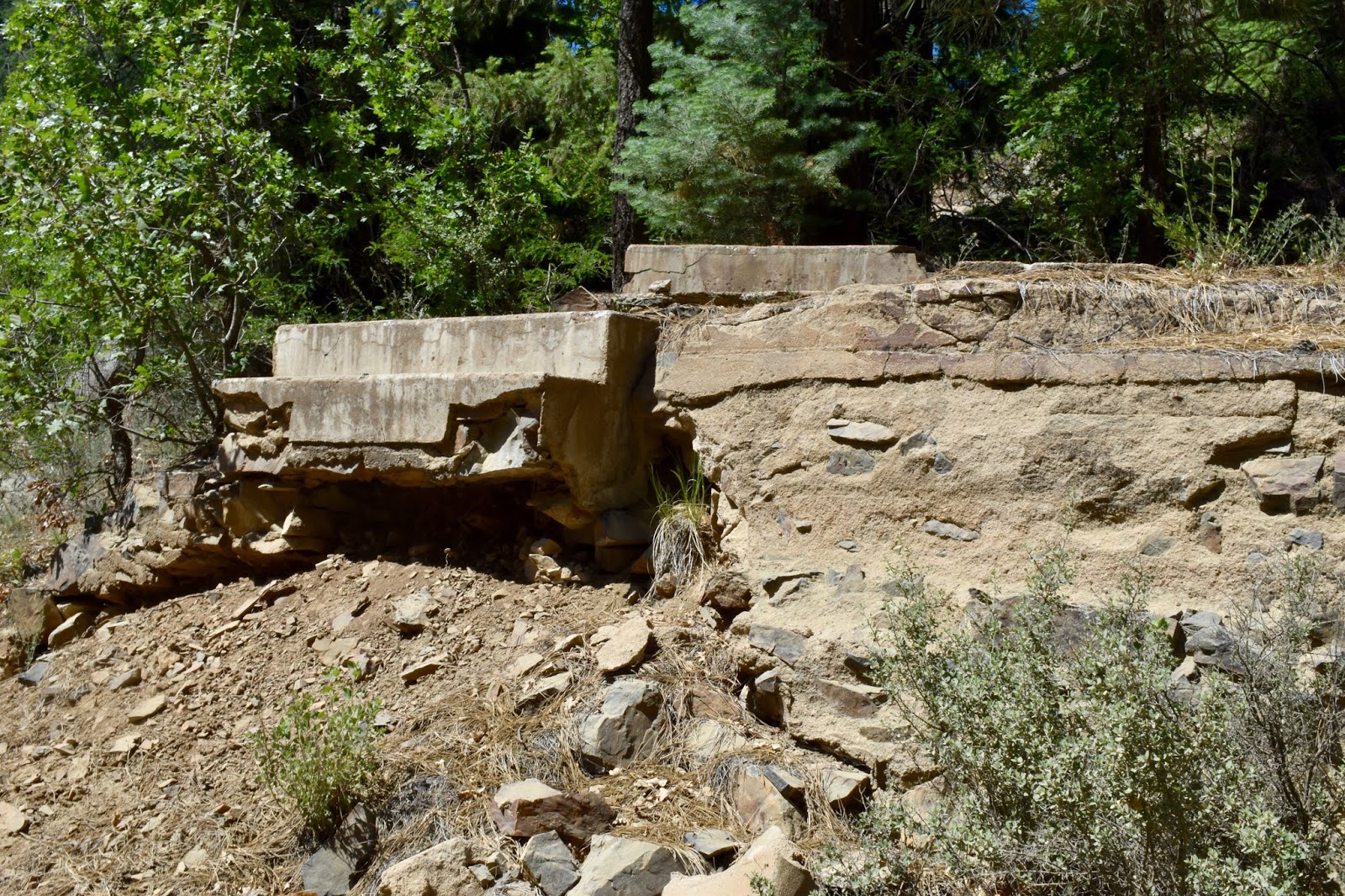
Then there are the remains of settlements and mines long gone and nearly erased, like the post office at Maxton (below) . . .

. . . with its steps to nowhere . . .
. . . and hundreds of treacherous deep mine shafts . . .

. . . and wells.

Many a traveler in the Bradshaw Mountains has stopped to admire and wonder about the Palace Station. On our journey, Chris shared what we had learned about Alfred & Matilda Spence, who constructed the log building in 1875 as a way station between the Peck Mine and Prescott. The Spences came to Arizona with Matilda's father, Richard Lambuth, and she remained in their home with her five surviving children until after Alfred's and Richard's deaths.


The family cemetery is in the woods nearby; unfortunately, all the original markers have been stolen with the exception of Richard's.


In the video tour, Chris tells so much more about that, while teaching about ponderosa eco-systems, how the Bradshaws were formed . . .

. . . and wildfire ecology.

As we completed our loop drive by coming down out of the mountains through Pine Flat . . .

. . . I photgraphed stunning mountains ridges . . .


. . . and as always, admired how the late afternoon light makes the mountains soften as if a light blanket has been draped over them.

The road was long, rough and winding . . .

. . . but the good news is that the journeys are all available at the Yavapai College website. I guarantee you will be amazed at how much you will learn as Chris weaves his educational and fascinating stories together.
