
March 25, 2019
Sacred Mountain . . .
It's odd, I admit, but I am occasionally surprised by what I find on my camera's chip. Whilst I was extracting photos from this past weekend, I found some pics from an excursion last fall with a few friends in the Verde Valley. Of course upon seeing the images, I remembered the delightful day; however, the name of the site we explored was a complete blank. And that's where the señor comes in . . .
No, he had never even been to the site, but when I showed him the photos, he told me the place name. Now how fair is that? I went there and can't bring the name to the forefront of my mind, and he knows it by glancing at several nondescript landscape pictures. Oh well, I'm glad one of us came through.
Sacred Mountain is the name of the place; it consists of the fallen remains of an extensive prehistoric hilltop pueblo just over the mountain from us in the Verde Valley. Two amigas and I from our side of Mingus Mountain arranged to meet our friend Nancy at her Camp Verde home, then to the site that she had chosen for our day's destination.
The Verde Valley Archaeology Center's website explains it thus: "Not far from V Bar V Heritage Site are the fallen remains of a 50 to 60 room pueblo with a classic Hohokam-style ball court at its base. There are three room blocks of about 20 rooms each on three corners of the butte, with the southwest corner exposed to form a plaza. The ball court, at the southeast base of the butte, is the last of the identified courts to be constructed in the Verde Valley. The ball court is difficult to identify since today it looks more like a depression caused by erosion."
Additional information about it can be seen at: https://www.verdevalleyarchaeology.org/SacredMountain.
The operative word being "hilltop", we had a bit of a climb to access the Sacred Mountain ruin site, but a rough trail that wound around the prominence eased the way.

Extensive broken potsherds litter the top and sides of the hill.

Outlines and remains of rock-walled rooms are evident throughout the mound top.

And of course the obligatory group shot, which I managed by balancing the camera on top of a wooden post.

The Peavine and the Dells . . .
To accommodate the aftermath of cousin Donna's knee surgery, we opted to hike on the relatively level surface of the Peavine Trail when she and Rob came to call. I never tire of that route's beauty with Watson Woods, Watson Lake and Granite Dells along the way. And then there's the convenience - the trailhead is a five-minute drive from home, so how could you go wrong.
Even more perfect, their visit was on a near-perfect spring day, so I was ecstatic to leave the harsh winter's cabin fever behind and soak up some rays.


I am a strong supporter of the Save The Dells movement that hopes to preserve that magical and irreplaceable region that is right in the heart of the Prescott area. Toward that end, I was at City Hall recently along with hundreds of others to further make my support known to the powers-that-be.


There's nothing like a good hike to work up an appetite, and since I love our Prescott downtown just about as much as the surrounding landscapes, we opted to head down to the historic Palace Restaurant and Saloon for a late lunch.
Not sure what the occasion was, but our stop coincided with that of a large number of marshals, sheriffs and possible miscreants in period dress from an earlier time. Not one to pass up a photo op, Donna and I invited ourselves into the midst of the local color. The dashing gentlemen were kindly amenable to being photographed with us.

The historic Palace is situated on Whiskey Row, and is said to be the oldest saloon in Arizona. Its predecessor was built in 1877 and burned in 1900 along with much of Prescott's downtown. The current establishment opened in 1901. Now as much a restaurant as a bar, the decor and ambiance beyond the front swinging doors transport a person to an era of simpler times.
The large handsome bar itself was saved from the disastrous fire by being carried across the road to the Courthouse Plaza while Whiskey Row went up in flames.


Our timing was perfect to arrive on Whiskey Row just in time to see a 1903 Oldsmobile. What an awesome automobile it is, and the occupants were superbly dressed in time-appropriate costumes. I would love to have gotten the entire story of the carriage and its owners; all I had time to learn was that they live four blocks from there, and that the vehicle is equipped with a modern engine, not requiring cranking to start.
The driver related that in 1903, two men had driven the same model vehicle across the country in 17 days by following railroad lines - now that would have been an adventure!

Getting there is half the fun . . .
Venturing a bit farther from home, we set off with friends Gail & Normand to see what the heavy winter precipitation had resulted in at Grand Falls. Although not classified in that upper echelon of wonders of the world, the lesser known "grand" is quite a sight to behold anyway. Grand Falls is located in northern Arizona on the Navajo Reservation.
As with most trips heading north this time of year, we wanted to stop at Del Rio Ranch north of Chino Valley to check out the bald eagle nest there. As is common, the pair of adults have raised two young who were busy flexing their wings atop the huge nest where they had hatched far up in a now-dead cottonwood tree.
 |
| Our traveling companions Gail & Normand loading up in our trusty Four Runner - known as Ruby. Actually, Ruby's trustiness is fading a bit as she requires a bit of major maintenance, but then, she's about my age in car years and I also require more maintenance as time goes on. |


On the downstream side of the highway bridge, the railroad's span crosses a deep gorge with some standing water in its bottom. The site is the headwaters of the Verde River which is probably my most loved place in the world as it winds its way through its various canyons until finally it pours itself into the Salt River.

Various remains of rock buildings are situated around the lake's perimeter. Initial plans in the 1930s were for a fishing/hunting location with a clubhouse and duck blinds; however, as things are wont to do on occasion, the real world interceded. The lake very quickly filled with sediment as the washes flowed into it depositing the silt they gathered along the way, and then there was the attack on Pearl Harbor and World War II. The grand plan fell apart; all that remains is a most-often dry ground depression behind a cracking dam and a few roofless buildings.


Grand Falls . . .
Our route took us through a snowy and water-logged region around Flagstaff - truly as wet as I have ever seen that country. And the San Francisco Peaks - Wow - eye-poppingly covered with snow!
The Peaks rise so majestically to be visible on the horizon from many vantage points - from Prescott and through the ponderosa forest around Flagstaff . . .

. . . and with a very different landscape as viewed looking south and with volcanic barrens in the forefront.

That prehistoric volcanic activity is what caused the Little Colorado River to change its channel, resulting in a 90-degree turn with a substantial drop over a series of lava ledges - Grand Falls.

After we had settled our eye teeth from the jarring of a long washboardy dirt road, we viewed the falls from above, where a surprising number of other folks had converged to marvel at the seasonal scene below. We have been to the site when it is completely dry, so the contrast made it even more remarkable.


As we walked along the canyon's rim, we continued to be amazed at each new vantage point . . .


. . . and of course posed for the shot that has probably been portrayed by most everyone who has visited there.

As long as we are there, we opine, we might as well climb down into the canyon to view the roaring cascade from yet a different perspective . . .

. . . and insert ourselves into the scene once again (at least I did not spray paint "Kilroy was here" onto the rocks).


 |
| Yes, those are walking sticks, but look how handy they are as a place to rest one's hands, should one need a place to rest one's hands. |
 |
| People in the foreground and a ramada on the far canyon rim give an idea of the gigantic size of the waterfall. Even from across the river, we got plenty wet from the mist and had a hard time hearing over the powerful roaring. |

What goes down must one way or another make its way back up - at least that's the way it is when one climbs down into a canyon. Looking back up at the steep climb up a jagged lava cliff was a little daunting, but we've done much harder.

The route out of there is from about where the folks in the photo below are standing on the river bank behind the mammoth upright to where a tiny person is visible on the rim.

Oh yes, there's that spot where we managed to drop down about three feet on the way in, but going up required an awkward scramble; it was just possible to hoist a knee up and then get an assist from above.

The chocolate water settles placidly into its revised course after the turbulence of the falls.

Niagara it is not, but Grand Falls seems to elicit a romantic notion, nevertheless.

Canyon Diablo revisited . . .
The site of a certain vanished settlement - Canyon Diablo - intrigues me, so the idea of stopping there for a second time on our way home from Grand Falls was fine by me. In fact, I expect I will return yet again for more exploration in the area.

The building ruins are not much different than when we first went there, but the lone remaining gravestone - for Herman Wolf, an early trader - was quite a bit more weathered into near illegibility.

The history of the short-lived town portrays a violence and lawlessness not often seen even in isolated frontiers. I wrote more extensively about Canyon Diablo in a previous post, so won't detail it here. It is at https://ritasjourneys.blogspot.com/search?q=diablo from a July 30, 2014, post. Very interesting place, but I would not have wanted to be there then.
The camp originated during construction of the transcontinental Atlantic and Pacific Railroad in 1880 when the building of a bridge across the arroyo delayed due to lack of correct materials. According to Wikipedia, the town sported "fourteen saloons, ten gambling houses, four brothels and two dance halls" in addition to two eating counters, a grocery and a dry goods store. Additionally, there were large numbers of tents and other abodes, probably mostly of a casual nature.
The canyon of the same name is an abrupt deep gorge cut into some of the rockiest most desolate plains you could ever hope to see. Top soil is nothing but a pipe dream there; even the fence posts could not be put into the ground: they were ingeniously placed in barrels weighted with the copious stones of the region.

Many former structures are now nothing more than brushy rubble piles garnished with the detritus of the erstwhile semblance of civilization.

Artfully arranged where it dropped, the fragile wooden remains pictured below appear to have once been a section of door frame.

We recognized the remaining ruins from our five-years-previous visit, but they clearly show steady deterioration. Each rock that falls from a wall lessens the structure's viability; another half-decade may leave little of what were once the impressive buildings of the Babbitt's Brothers Trading Post and its outbuildings across the railroad tracks from the town site.
The five Babbitt brothers came to Flagstaff in 1886 from Cincinnati, Ohio, to establish a cattle ranching operation - the CO Bar Ranch.
According to the Babbitt's Wholesale website: "In 1891, the Babbitt brothers established themselves in the Indian trading business, acquiring the Red Lake Trading Post northeast of Flagstaff. Over the next 100 years, the Babbitt family owned and operated over twenty trading posts on the Navajo, Hopi and Apache Indian reservations in Arizona. Some of the best-known Babbitt posts were located at Tuba City, Willow Springs, Canyon Diablo, Cedar Ridge, Tolchaco, Indian Wells and Oraibi."
In the photo below, Gail stands against the back wall of the largest building to give it scale; it may have covered 6-7,000 square feet.

The San Francisco Peaks are visible far on the horizon; they and the canyon depths are about the only visual relief to the rock-strewn flats.


Original use of some of the ruins are unknown: was the very deep large covered structure pictured below a cistern? If so, how did the water get into it or was it a dry goods vault or something entirely different.


As with all abandoned places, the stories of the people who lived and toiled there are reduced to conjecture, and we do plenty of that as we seek their history.


And like the best of days, that one concluded with a meal enjoyed with our friends on historic Route 66 in Williams, Arizona, but that's another story.

To round out our week of activities, most welcome after a long cold winter, cousins John & Patty invited us to tour the Verde Valley attraction called Out of Africa with them. I jumped at the opportunity to spend time with them while enjoying the wildlife park that I have somehow managed to defer for more than 20 years despite its proximity to us.
The 100-acre park is the brainchild of Dean and Prayeri Harrison, a couple who began their journey by incorporating big cats into their home. Out of Africa includes animals rescued from hostile or untenable conditions, and encourages education and relationships with the wildlife.
And . . . it was a fun excursion!
I have never been as up close and personal with a giraffe as we experienced during our tram ride.

In the next picture, John is seconds away from an unforgettable slurpy sandpapery kiss.

It's often all about the people for me, but in this case, it was all about the animals. Below, Patty is getting a shot of John's giraffe pal helping itself to another tidbit.

Eventually, I gave up photographing wildlife through chain link fences and just enjoyed the sights. No idea how many animals populate the place, but there are tigers everywhere and the variety of wildlife is astounding - everything from Watusi cattle with horns that put a longhorn to shame . . .

. . . to reptiles of gargantuan proportions . . .

. . . and colorful countenances . . .

. . . and including a rhinoceros that bore a distinct resemblance to the statue at the park's entrance, and that was just about as animated.

Despite the fence distraction, I couldn't resist this shot - look at that face!

The tigers are the real stars of the show . . .

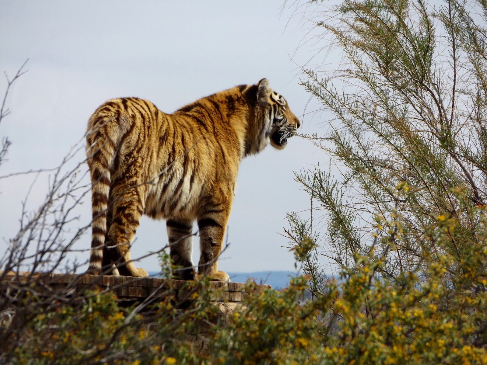
. . . and the Tiger Splash is amazing to experience! I could scarcely believe my eyes as staff members present themselves as prey to the tigers to entice them into the pool as they interact in and out of the water.


Believe me when I say the tigers move very fast!

And so we ended our day exhausted and amazed and determined to return; there is far more to be experienced at Out of Africa than can be done in a day.