Fish mouth
The name was not the first thing I would have conjured at the sight of the cave, but it is one of the more impressive caves I've ever come across. Visible from a great distance, but a trek is required to arrive there.
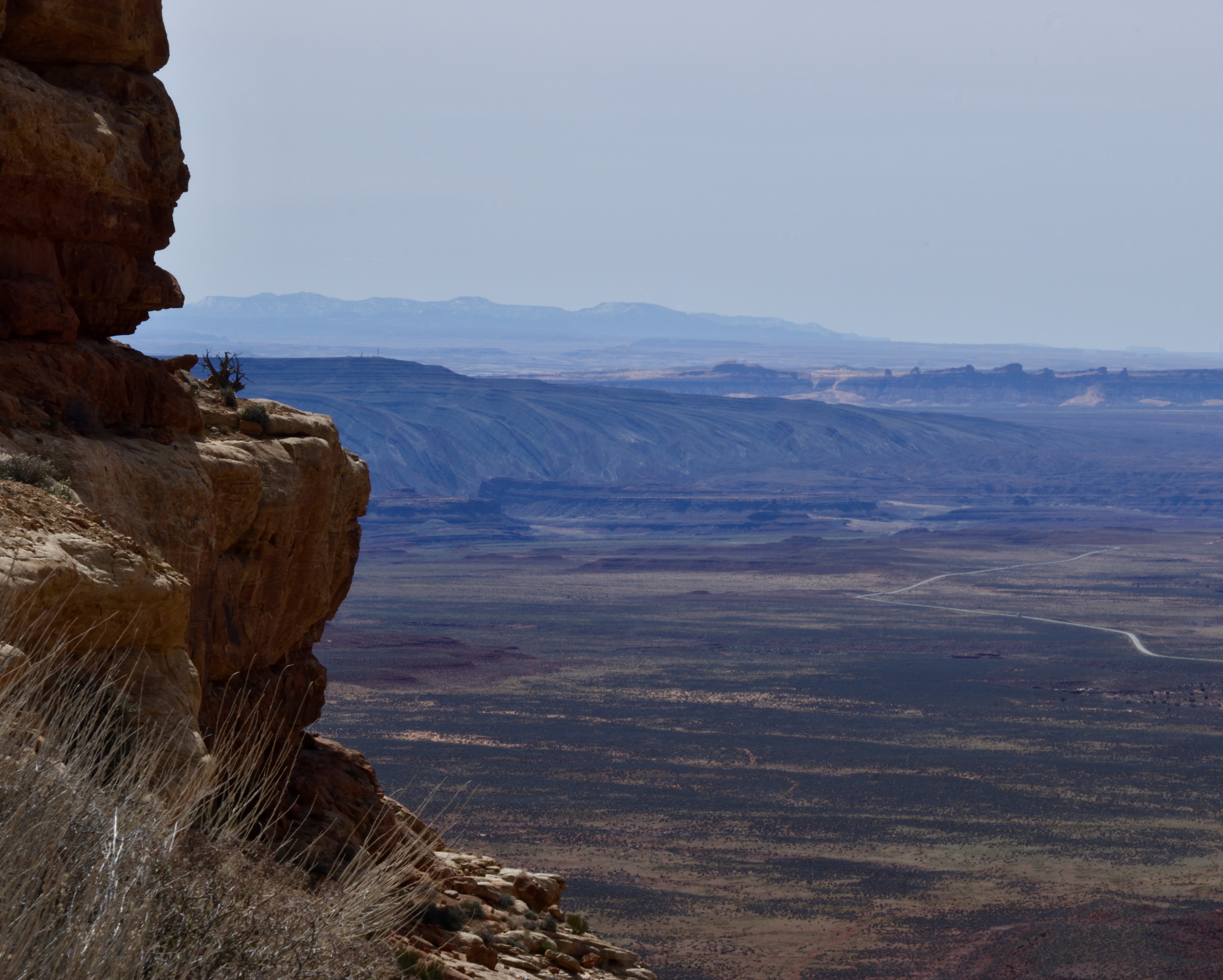
From a distance . . .


We were less interested in the cave itself than the cliff dwellings that were said to line the canyon, and in that, we were not disappointed. Getting to any of these many sites tucked up into the canyons of Comb Ridge requires crossing at least one deep wash and several other drainages, so plenty of up & down climbing with that. Once that is accomplished, the rocky clefts vary in steepness and roughness of footing.
Relatively speaking, Fish Mouth ruin was not too precarious a climb. The south-facing cliff face held a series of spaced out prehistoric dwellings, all of which we explored.


I am fascinated by the differences in architecture and features from one site to another, often even with ones nearly adjoining.
It seems impossible that bits of tiny corn cobs, and in one case even husks, exist after such a long time . . .

. . . and how amazing to see these marks from fingers that so long ago worked to mortar and plaster the walls of their home. . .


I spotted a beautifully painted potsherd, part of a broken mug handle.

I love keeping an eye out for the incredible beauty all around - whether everyday landscapes, stupendous vistas or tiny underfoot flowers.


There's something about a deep sandwash that lures me on just to see what's around the next bend, which is usually more deep sandwash.


While wandering here, there & the next place, we're never sure just what we'll find. Sometimes it might be a fabulously striated mountainside.

Another time, while trying to locate what looked like water from a distance but where we knew there was no lake, we came upon a real odditiy: a huge expanse of gravel that signs informed us was irridiated uranium mine tailings! The mine itself must be vast, but we have no idea of its location, or why Mexican Hat was chosen as the place to be irradiated.

And speaking of Mexican Hat, this is the delicately balanced rock of that name.

At another place after seeing water on the road, we walked to discover whence it came. We found a large area covered with thick dry grass only to discover that there was standing water from a seep spring at that spot. It was impossible to tell with the thick vegetation covering it.

Following the flow downstream, it led to quite an impressive wet canyon bottom.

San Juan Hill . . .
One historic site I wanted to visit was out of bounds because of high water. When Mormon pioneers were attempting to settle that area of Utah, they were confounded by the impassibility of Comb Ridge. With a nearly unbelievable determination, they finally cut through the end of the ridge where it joined the San Juan River.
Although we headed that direction following their covered wagon route, we were thwarted by the flow of Comb Wash, often a dry bed, but at that time flowing high and swift. Thinking we might discover a way to get to San Juan Hill, the señor went to Bluff Fort, and there he met the great grandson of Platte Lyman, the leader of the bunch that managed to breach Comb Ridge in 1880. As interesting as that was, it did not get me to where I wanted to be, and indeed, he informed us that even in dry times, we would need four-wheel-drive for the feat.


I keep forgetting to include what birds we have identified on the trip, so am lumping them all here.. We got western bluebird, collared dove, mourning dove and black-chinned hummingbird at the RV park, as well as other locations. Others we've spotted include piñon jay, Woodhouse jay, Say's phoebe, raven, robin, black-throated sparrow, violet-green swallow, white-throated swift, green-tailed towhee, spotted towhee, yellow warbler, yellow-rumped warbler, downy woodpecker. Obviously we have traversed some very different habitats.
One exciting spot was a black-throated gray warbler that landed in a bush right in front of us while we were enjoying our lunch far up at the head of a canyon.