
August 24, 2013
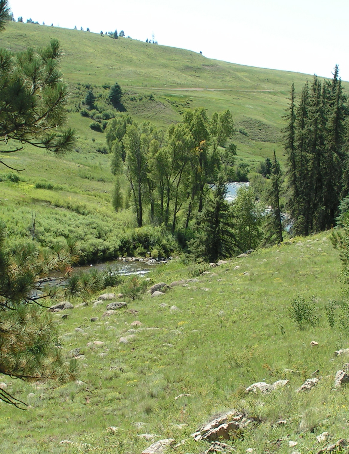
Once again we found ourselves ensconced on the bank of the San Juan River in the Riverside RV park just outside of Pagosa Springs, Colorado, an area that scratches lots of itches for me. There is river (it’s at a higher level than it was last year), mountain streams, waterfalls, high country lakes, birds galore, lots of game, and endless miles of forest, mountain and meadow to explore.


The more solitary jays, western scrub and Stellar’s, stop by for a skittish bite, then vamoose to a nearby tree. As we have in the past at this location, we saw a nearby Lewis’ woodpecker.
We were so inspired by the sight of western birds at La Veta that, like the proverbial kid in a candy store, I had to purchase a thistle seed feeder and a seed log to entice others of the avian variety. There were large flocks of goldfinches at La Veta feeding on weed seeds and at the neighbors' feeder, but here nary a one.
Our drive to Pagosa took us over La Veta Pass and Wolf Creek Pass. I have driven Wolf Creek myself in days gone by and enjoyed it very much; however, the caution that comes with more advanced age seems to clench me up a bit as Chris pulls the trailer up and over that mountain. He is a careful and confident driver, the only thing that keeps me from curling up on the floorboard with my eyes closed. Of course there is the magnificent scenery, too, and I’m always on the lookout for whatever might come into my line of vision.
It was shocking to see the incredible number of dead spruce near the summit - I would have to guess between 75 & 90 percent of some huge stands have succumbed, evidently to bark beetle infestation.
Before we crested that part of the San Juans, we traversed lower elevation sites that we have enjoyed a bit but that still remain on our “to explore” list. Places such as Alamosa, Fort Garland and their environs leave much to be seen; our previous stops have been short for one reason or another. We fondly recall our time at the Great Sand Dunes, something I had no desire to see because of a preconceived notion of what I would find there, but that turned out to be a memorable day indeed. The historic Fort Garland was also very interesting, and there is much more in the area to draw us.
Hotshots . . .
I was touched to once again see that others stand with Prescottonians in honoring the fallen 19 Granite Mountain Hotshots as we have seen across the country. I stopped in the Pagosa ranger station to thank them.


My goal-oriented fellow traveler read about a place called Silver Falls, so off in that direction we ventured. We began on a winding dirt road taking us upward; after all, we are in the Rocky Mountains - everything is either up or down, depending on your destination.
The travel surface left something to be desired, but then, we have been known to drive on what some might call non-roads, so that was not an issue. Truthfully, though, this particular road got to be exceedingly gnarly and rocky, but it was the sheer spalling rocky cliffs towering hundreds of feet above us on one side and the same sheer spalling rocky cliffs dropping hundreds of feet below us on the other side that got my attention.
There is a reason why there are house-size boulders in the stream bed below and why there are rubble mounds of other fallen stones along the roadside and that reason is that they break loose from the cliff face and tumble downward with great force.
Faced with the evidence of this happening was plenty to make me wish I were already through that stretch and that I would not have to return that way. I deferred to my intrepid driver, however, and on we went as storm clouds gathered over the peaks high above us. I carefully kept watch down below the road as if somehow that action would insure we didn’t end up down there; as I kept my eye on the canyon floor that was becoming less and less distant, I saw a doe looking up at us. Of course that necessitated a photo stop and as I prepared to take her picture, her cute little spotted fawn bounded out into the open with her.

I was further distracted from the tension (it doesn’t take a lot for me) when a huge osprey came slow-flap-flapping its way down the canyon right over us and carrying its catch in its talons.

 |
| There was quite a diversity of geologic strata, some beautiful outcrops, along the way. |


Beyond that spot the road becomes a jeep trail that, based on descriptions from those who have done it, I would be completely unwilling to try even in a tank. Historically, it is significant, being the very first road over the San Juans. Given the difficulty of the route, I can’t imagine what the alternatives were like.
Wagon travel commenced over Elwood Pass in 1874; by 1879, the military was using it, allowing access through the mountains instead of the previous route that went far south via Santa Fe to come up the other side of the mountains.
The lure of mining opportunities were doubtless the impetus to find a way through that seemingly impassable range. Summitville, a ghost town appropriately named, is high up above where we stopped, amidst the ore tailings on the mountain slopes.
An 1874 San Juan newspaper described the route as a “perilous journey”.
According to an interpretive sign, “The road never was very good. Even the 1878 Corps of Engineers report recommended not building a military road from Ft. Garland over Elwood Pass to Ft. Lewis, then in Pagosa Springs.
It was built anyway. The ‘Old Military Road’ branches south to Alamosa after you cross the Pass. The Army quit maintaining the road after Ft. Lewis moved farther west in 1881 to Hesperus. Settlers with their oxen, prospectors, and visitors to the Pagosa hot springs all traveled over Elwood Pass. You can even see the remains of the 1907 Monte Vista/Pagosa Toll Telephone line.
The trip was difficult: history records a crossing in 1876 that took three weeks to reach Pagosa Springs from Summitville, a distance of only 30 miles! The San Juan flood of 1911 and the road’s difficulty convinced engineers to locate the new automobile road over Wolf Creek Pass bypassing Elwood.”
Silver Falls . . .
Once we had gotten to the place where our hike to Silver Falls was to begin, the sky was alive with rumbling and the threat of rain had become a reality. Having once had lightning strike my house with a bolt coming right out of the ceiling near me, I have developed a healthy respect for the deadly phenomenon.
That said, it is clear that when God was passing out caution, I was last in line and did not receive my fair share. Chris, on the other hand, didn’t even bother with that line; I sometimes think he also bypassed the queue for common sense, the result being that we determined to embark on the short climb to a place to view the waterfall despite foul weather. I will give us credit for at least doing so with dispatch.
Taking what Chris calls a “calculated risk” and what I deem to be just plumb crazy, we climbed uphill along the rapidly descending water, a fairly short but steep walk until we were at a place to see the waterfall, about 150 feet above us. Because we were not struck by lightning then or on the hike back to the truck, I can now say it was well worth it all.
What a strikingly beautiful sight it was! One side was a foamy cascade; the other gave the appearance of strings of silver balls - fully living up to its name. I regret to say that because of weather conditions, we admired the stream’s chute for the minimum time that seemed appropriate and then hightailed it back to safety.

Piedra River Canyon . . .
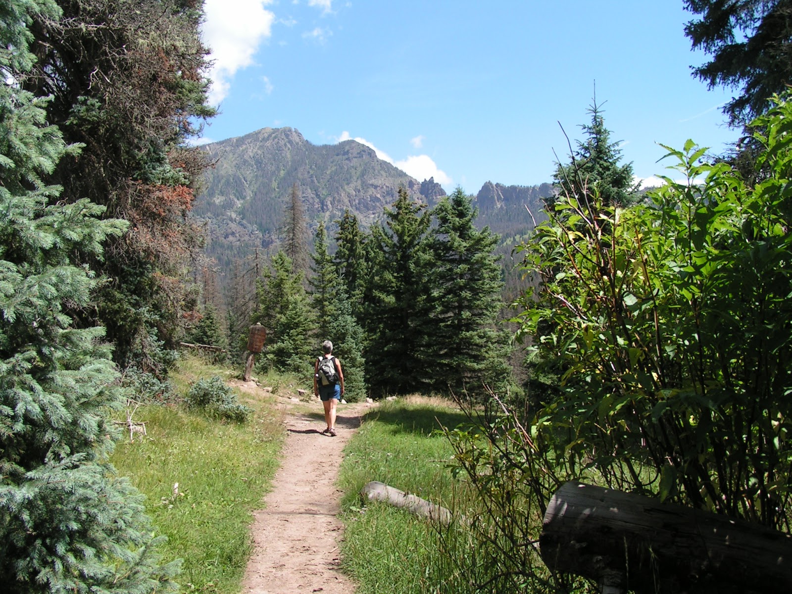
What to do when one is surrounded by massive mountains in such an expansive landscape? It is just too immense to take in without cutting it up into smaller bites. That is what we did when we chose the Piedra River Canyon for a hike.
Truthfully, at the trailhead, I was more than dubious. It did not intrigue me at all and I would have chosen a different place to explore. I am very grateful that I deferred to Chris’ decision to follow that watercourse downstream.


The Piedra flows downward in an everyday-river kind of way along a portion of its course, but inside that particular rock canyon, it has carved out scenes of great beauty.


Yet another bite out of this gigantic landscape - we drove up the mountain to embark on the Four Mile Creek trail for however long we could remain upright and putting one foot in front of the other.


I was quickly disabused of that notion: throughout its length, the trail was mostly steep, doing a roller coaster imitation, only far, far slower.


There are allegedly waterfalls on that creek we crossed several times: one three miles in and one at four miles; however, the proof of that for us will await another day when we are better conditioned and acclimated. Chris estimated we were about halfway to the first cascade when we opted to turn back. We were certain we could have made the distance, but not quite as sure that we would get back out before: 1. We collapsed, or 2. It commenced to rain, or 3. A bear attacked us (there was bear sign along the trail; be assured I kept my pepper spray at hand).
The views on this hike were as stupendous as any we’ve seen, seems a person can’t go wrong wherever one turns in these mountains.
The bonus was the raspberries that we gathered along the way (that’s the royal “we”; Chris did it). They went into fruit salad along with the sugar sweet Palisade peaches we bought at the local produce stand, the same place we have been obtaining local peaches and Olathe sweet corn daily - scrumptious!
This was the third time we have encountered blue grouse in the Pagosa area, twice while driving. They blend perfectly into the underbrush, but seem to have a penchant for crossing the road in front of us - one even recrossed while we watched as if to give me a better photo op.

 |
| Why did the blue grouse cross the road? Probably to give me a better photo opportunity. |
Aspen, fishing, rain . . .
Many of the stands of aspen we have seen recently have had a much darker hue to their bark than is typical, although we are clueless as to why; we can only surmise that weather conditions have affected them. In the Four Mile Creek area, however, the trunks had the whitewash appearance we are more familiar with.
As we climbed higher and higher, it was fun to see their wiggly/giggly leaf dance as the humorless stolid somber spruces stood watch.
We have managed to get in sufficient hiking and adventures despite daily or nightly rain. In the past 44 days, there have been only two without rain. Conveniently, much of it has been during the night hours, which interferes with sound sleep, but allows us to go on our way without much interference.
Everywhere are creeks, streams and rivers that my imagination says are teeming with trout, and well they may be. The next time I come to Colorado, I will be doing some serious fishing, perhaps after finally leaning how to fly fish - hoping Sharon, my fly fishing friend, is still amenable to teaching me the techniques.
The Springs . . .
Pagosa’s major claim to fame is/are the hot springs. The Springs Resort is a single place but it sounds odd to use “is” with it, so I’m just covering my bases. These hot mineral sulfur-smelling springs have been utilized surely for as long as man has roamed these mountains; their therapeutic soothing properties are now available through commercial means, the primary one being at The Springs Resort.
Happily, one needs not room at the resort to enjoy the bathing, thus this RVing couple can therapeut to our heart’s content, as long as we pay the admission fee, of course. Our habit, or should I say our addiction, is to spring (ha, ha, little pun there) for the economical weekly rate and to sally to and fro at the pools as we desire.


The beautifully landscaped slope just above the San Juan is dotted with various sized and heats of pools, ranging from 96 degrees to the Lobster Pot at 109, hot enough for me to keep a wide berth from it. Several have waterfalls incorporated into their design. I am in heaven when I stand under one of those, chin tucked to chest, eyes closed in a zen-like state while the water pummels my head, neck and shoulders.

 |
| People are not allowed into this large pool where goldfish reside. Chris-a-pedia says they are grouped where the water enters because there is more oxygen there, that hotter water has less oxygen. Who knew? |

I long for a real house with a real shower. Speaking of a real house, we will be back in Prescott on Sunday and have already set an appointment with our realtor for Monday. The search for a home begins then, hopefully to culminate in finding the just-right place for us in a very short span of time.


 |
| Rowdy pointed out to us this salamander that took up residence under the trailer. |
 |
| Another nice mural along the way in Alamosa. |
 |
| Our neighbor chimed in with his 12-foot Alp horn, not your usual RV park musical instrument. |
No comments:
Post a Comment