
The ups and the downs
Explorations undertaken in this country are filled with surprises. The majestically rising plateaus ringing our location are the predominant obvious features, but the stupendous canyons with their tributaries snaking stealthily throughout the landscape add to the intrigue.
What appears to be vast stretches of featureless plains are anything but featureless. Short walks and drives quickly reveal dropoffs at every turn, gentle washes that quickly become narrow arroyos and that deepen quickly as they cut down through multiple rock layers. They twist and turn often as the underlying stony structures yielded to or resisted the eroding water and wind.
House-size slabs of rock hang out over sandy wash bottoms or threaten to crash down onto slick rock surfaces. The tortured stony sculptures are beautiful and fascinating as we hike down the canyons, waiting to see what wonders await at every turn.
Badger Creek . . .
Beginning near the foot of the Vermilion Cliffs, we tried out the señor's hiking abilities in several different locations. Because of the tremendous elevation drop in the relatively short distance from the high escarpments to the Colorado River in Marble Canyon, the sandy washes cede quickly to dropoffs and dry waterfalls that make the way difficult to impassable.
Instead of walking into the Badger Creek drainage, we viewed its depth from up top, not always a comfortable proposition for me. One ridge we wandered out along put me in mind of an ant lion's den, in that its loose gravely surface sloped quickly toward steep cliffs in the depths on both sides. I went out there but it was with some trepidation.


Knowing that, we assumed the places where we saw tiny cacti that had been marked protectively by a small ring of rocks were the succulents in question.

Later research revealed that the persnickity plant prefers specialized soil that is predominant in a less-than-30-mile area near Marble Canyon. It grows only on chips of Kaibab limestone that overlay soils derived from Moenkopi shale and sanstone outcrops that occur on gentle slopes (that slope was not gentle enough to suit me, however) at a certain elevation range of only about 500 feet variation.
Just think if humans were that careful about their diet; we would either starve or be very very healthy.
Views back toward the lodges at the foot of the Vermilion Cliffs gives a sense of the scale of the landsape.

Soap Creek . . .
We checked out Soap Creek from the bottomside instead of the slippery slope side as at Badger Creek. It began innocuously enough with a deep sandy surface (awesome for working out the leg muscles and lung capacity!) with slick rock ledges here and there. It would have been pretty impressive to have been there when that boulder dislodged to land precariously!

The walk quickly took us deeper and into more and more spectacular surroundings with each turn of the canyon.


We lunched in the shade of this overhang. That alcove may not be there for the next trip; the entire rock cliff is undercut by at least ten feet, so it's just a matter of time before the weight above topples into the creek bottom.

One last turn ended our trek: we came to a waterfall that was beyond the señor's post-surgery abilities. It is known as a route to Marble Canyon, and in times past, we most likely would have made the scramble. We've done worse, after all, but a bow to sensibilities of "taking it easy", as the surgeon advises, caused us pause. We surveyed various possibilities for the descent, none of which appeared to be in the cautious category, especially since we would at some point be required to climb back out.


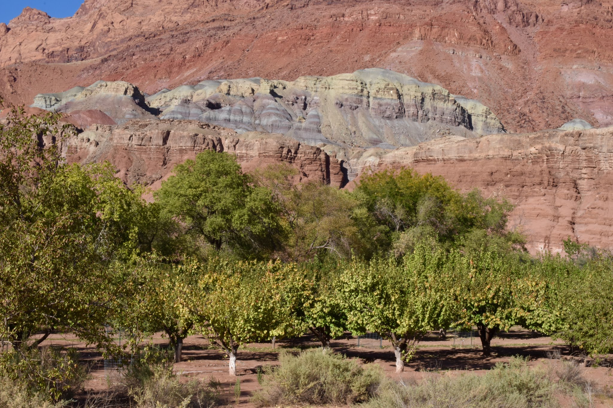
Lonely Dell, Lee's Ferry . . .
The well-known and most visited place in that area is Lee's Ferry, a historic spot that got travelers across the Colorado River at the only possible crossing site for hundreds of miles. Because of the development of that ferry at the behest of elders in the LDS church, northern Arizona sites were opened to settlement.
Previously, the forbidding landscape made it impossible to access that region.


In 1871, John D. Lee was the first to provide ferrying service across that mighty waterway, getting people and wagons to the south side where they then intrepidly made their way along the precarious steep rock face and finally down to safety.
Lee and his first wife Emma were succeeded at the remote site she called Lonely Dell by others who helped develop and operate the way station, where they cultivated extensive crops and orchards to sustain them in a place where they supplied the sole source of sustenance.

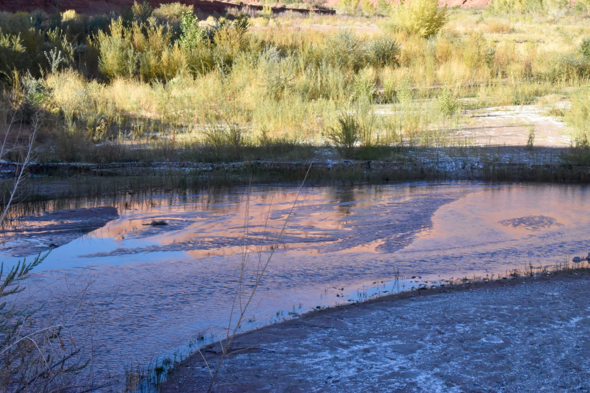
The historic site sits beneath stunningly beautiful escarpments where the Paria River joins the Colorado before its pours through Marble Canyon. Subsequent ranchers have come and gone; the place is now administered by the National Park Service. Some early structures remain and have interpretative signage about their uses and the people who resided there.
It is a peaceful place and one of my favorites. We had the great pleasure to continue up the course of the Paria, a canyon of great beauty and grandeur.


Okay, I was pretty darn scared on the very narrow section of trail that threatened to send me slipping off into the river - a slippery slope indeed.


Totally satisfied with the day's journeys, we returned to enjoy the last of the sun's rays on the clifftops over the Colorado.


I am fascinated with the ways that people persevere through seemingly impossible situations, and figuring out how to ferry travelers across that river onto canyon walls is one that gives me pause for sure.
When wagons gave way to automobiles, another method had to be found because motor vehicles couldn't ascend the very steep grade that horse-drawn conveyances used on the south side of the river. How I can't imagine, but a road was built along the cliff face to get motor cars off the ferry and around the escarpment.
Peering carefully across the way, a person can just pick out sections of the road that were shored up with stacked rocks as shown in the next photo.


No comments:
Post a Comment