
It's all about volcanoes
July 5, 2017From our perch near Hat Creek and Old Station, it is all about volcanoes for hundreds of miles around us. On the other hand, for some folks, it is all about trout fishing, timbering, or the Pacific Crest Trail.
And now we have hiked on the Pacific Crest Trail, but primarily in seeking all things volcanic. Last summer, Chris’ quest was for all things dinosaurs; this week near the active volcano, Mt. Lassen, was entirely my doing.
Previous visits were of the let’s stop here on our way through variety. I was seeking more exploration. Who could have known that the winter just past completely bolloxed up the park service’s plans to open Lassen’s largest hydrothermal area, Bumpass Hell.
Needing to see for myself just why that section was unavailable to me, we drove right up to the road closure sign and then walked in another quarter mile, where it became crystal clear why things might be running behind schedule.
It defied belief that the snow could be 30 feet deep still on the 4th of July, but there it was sure enough!

 |
| The end of road clearing efforts after an equipment breakdown. The three dots up on the snow ridge are three young people who ought to have known better. The two boys made it to the top; we didn't stick around to witness what became of them after that. The young woman sledded down the mountain on an air mattress (below). I was grateful that after her screaming start, she swooshed behind a ridge and I did not need to see how her adventure ended. |

The drive up the mountain was spectacular enough to satisfy us that it was not a waste of time. Snowy lakes just beginning to thaw showing azure hues beneath the ice, bogs and ridges with wildflowers blossoming in profusion despite winter’s snow remnants just feet away . . .


. . . and then there ware amazing sulfurous steam vents and bubbling mud pots. At the so-called sulphur works, we learned that an Austrian entrepreneur, Mathias Supan, actually mined the sulfurous deposits in the 1860s and fashioned them into potions that he labelled as medicinal and peddled them in the town of Red Bluff. When such potions as Supan's Baby Colic lessened in popularity, the family established tourist-oriented attractions. The Supan family's holdings were acquired by the National Park Service in the 1950s.


 |
| That thick muddy cauldron is about ten feet across and is boiling and steaming away emitting the tell-tale rotten egg odor. |

Speaking of Red Bluff, I was going to mention the larger-than-usual feedback from the last blog post. Evidently, Burney Falls is pretty well known: Carol & Gene have been there, as has Phyllis R. Carol’s granddaughter lives in Burney; Scott R.’s daughter lives in Shingletown near here. Denis has hiked on Shasta with friends and climbed to the top of Lassen with his daughter.
One of the more interesting responses was from Phyllis who said her grandparents lived in Susanville in 1915 when Lassen Peak performed its last major eruption. That’s 100 miles away; nevertheless, they would have heard, felt and seen the event from there.
I found a photo online of people in Red Bluff, equally distant, looking out at the six-miles-high ash plume rising up from the mountain. She said her grandmother didn’t realize the mountain was a volcano; can you imagine the shock of that!
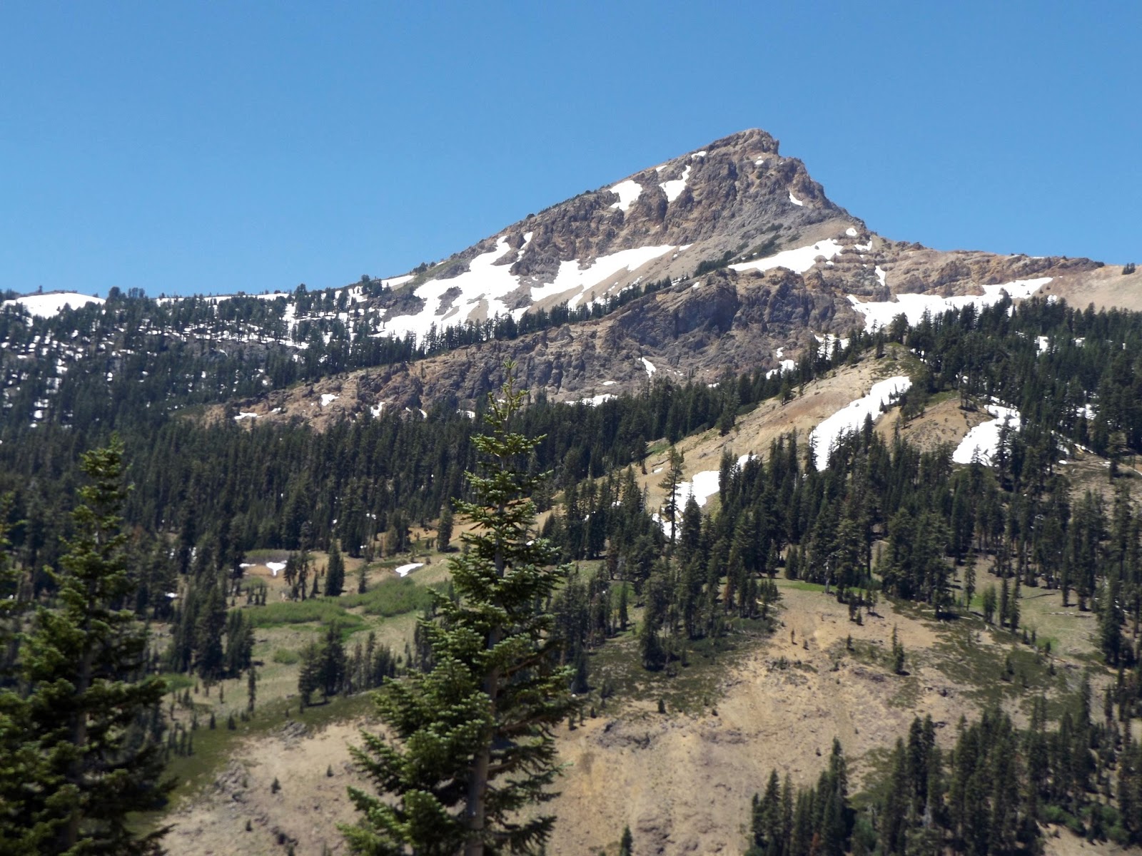
Various crests, including Brokeoff Mountain, ringing Lassen Peak are remnants of the rim of an ancient humoungous volcano called Mt. Tehama.
The best laid plans . . . again . . .
Various entrances to Lassen National Park itself are many(!) miles apart. We parked the trailer at what initially seemed to be a centrally convenient location. Just like the bear that went over the mountain, we fully intended to do the same in order to access other areas of the very large park. There’s that Ma Nature again: the road over the mountain is closed, so we drove waaaay around to get to the “hot” section and then back to another entrance to lesser-visited region with hydrothermal activity, all of it necessitating a hike to see. Even then, it’s not easy: one trail leads off one way and another two trails another direction. Decisions, decisions - picking one, off we went toward Boiling Springs Lake.
Pacific Crest Trail . . .
Our trek to the lake was partially via the Pacific Crest Trail, known locally as PCT. Many businesses, churches and other enterprises cater to the trekkers, offering hostel lodging, meals, wifi and mail drops for those who are hiking for extended periods.
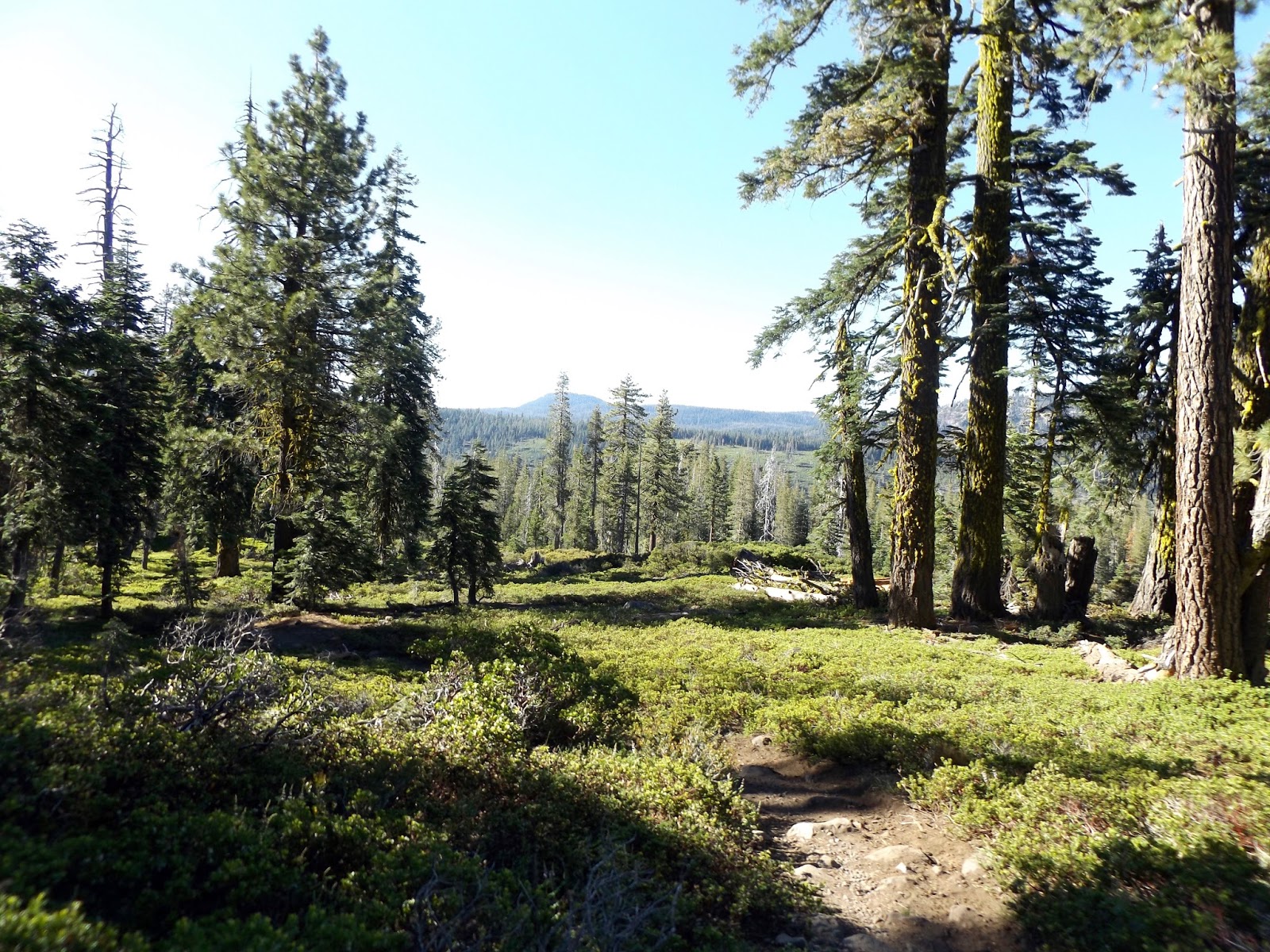
Interesting route: the trail led through some lushly green meadow lands at the start and utilized boardwalks to get hikers through the wettest sections before becoming a vague path through the trees.


In the midst of the meadows was a stream so hot that you could do no more than swish your fingers quickly across the surface.

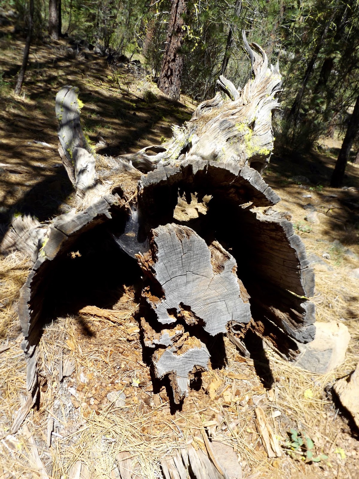
Most of the distance to the lake was through heavily forested mountainous terrain. There are many enormous trees of various varieties throughout those woods. We were very curious about a number of gigantic incense cedars that had large burned-out hollows at their bases, but which seemingly continued to thrive. I hope I can find an answer about what caused those mysterious situations.

 |
| This is the top of the same tree Chris is standing in (above photo). |

Boiling Springs Lake . . .
Boiling Springs Lake is aptly named, and is easily one of the odder things I’ve ever seen. The water has a milky hue and is ringed by barren mineral flats, occasionally dimpled with water-filled pockets.


At one end are large mud pots that boil and toil like Shakespeare’s witches’ brew. Over the entire basin in which the lake lies is the smell of sulfurous emissions. Those springs are beyond bizarre: the boiling sounds coming out of them is like a distant deep-toned drumming that you could almost think is emanating from some distant other-worldly drummer.
Terminal geyser . . .
Because of our loooong drive around the mountain and other shenanigans, our times in the hot spots was a little shortened. After Boiling Springs Lake, we could choose to return partway on the hike and troop another few miles out to Devil’s Kitchen or we could loop around the lake and go on toward Terminal Geyser, but we most likely would not be able to do both. Tossing an imaginary coin, we chose the geyser.
After the previous day’s hike that was purported to be gradual, but which was most assuredly not, I was thinking something not overly strenuous would be just the ticket. After all, this 6.5-mile trek seemed like plenty after the previous one.
Getting to Boiling Springs had been primarily uphill, a very good thing in my book, because that meant coming back out would be downhill. And there went yet another plan shot to pieces: leaving the lake and proceeding to Terminal Geyser started out as a gradual downhill and then gave up the gradual part entirely, much to my dismay.
It then became a “We’ve come this far; we might as well finish it” kind of a thing, and I was very glad we did. Although my leg muscles were protesting the next morning, the geyser that really is not precisely a geyser was totally awesome.
For most of our time there, we had the place to ourselves. A couple of trekkers from the Czech Republic stopped briefly. Without any English, he managed to ask me if it was going to shoot water into the air and with no Czech, I managed to tell him no. I think he was expecting Old Faithful.
I’m not entirely certain why it’s called a geyser instead of a fumarole or steam vent (I think those two things are the same; I am not overly conversant with all things volcanic) since it does not shoot water into the air as it seems any self-respecting geyser would do.
At any rate, Terminal Geyser was worth the 6.5-mile hike - it had huge plumes of steamy gases erupting from beneath the jumbled boulders, with a cold-water spring flowing down the mountain near the boiling-hot stream emanating from the geyser.


By propping the camera on the air horn I was carrying to ward off any bears that might be inclined to attack us, I even managed to get a photo of us smilingly breathing in gases from beneath the Earth’s crust.

 |
| We encountered these warning signs occasionally, even when there was no trail, sidewalk or boardwalk, leaving one to wonder exactly what trail, sidewalk or boardwalk one was supposed to be utilizing. |

A grouse (not Chris this time) . . .
As we neared the end of our hike, I spotted something up ahead on the boardwalk; we were excited to identify another life bird - a sooty grouse and with a brand-new chick, no less. The mom seemed to want to stay up on the boardwalk because of her baby that might be overwhelmed by the trailside vegetation. I was able to observe her displaying with her tail feathers spread.


Eventually, we approached even closer and the baby ran right by us while mom called excitedly from the underbrush where she had flown.
Other birds we added to the list include American crow, yellow-rumped warbler, Townsend's warbler, dark-eyed junco, bushtit and spotted towhee. We were surprised to see a pair of common nighthawks when we stopped for a last binocular view of Mt. Shasta.
We actually got white-faced ibis while being slowed in July 4 traffic as we drove across the bridge at Almanor Lake on the way to Warner Valley. That looked like a wonderful birding area, but we were so late returning through there that we couldn't stop on the way back.
Bears!!!
As we began our drive out of Warner Valley, we spotted a deer munching its evening meal, a bucolic scene . . .
 |
| But what in the world is that hole in her flank? |

I digress, again . . .
Lassen’s seething, simmering, smoking countenance was not my only reason to visit that region. My heart hearkens back to youthful times spent in those forests.
As yet one more in a long line of hopefully gainful pastimes, Dad and Uncle Lewis made successful bids with the Forest Service to perform gooseberry eradication (I think the plants were considered harmful to the young conifer trees by carrying contagious disease), and I was along for the ride in those long-ago days.
The drill went something like this: our two families would travel to my grandparents’ farm in Oroville, where Mom and/or Aunt Margaret remained while the men camped near the work sites. Naturally, I chose to troop along for the adventures, often accompanied by my cousin Johnny and occasionally by my little sister or brother - Vicki and David.
Sometimes, we youngsters would tag along to hike through the woods with our fathers while they, and occasionally we, worked. Other times, we would remain behind and wander at will by ourselves. We knew there were bears out there, but no one seemed to be concerned for our welfare. Once, a bear raided our camp, but even then, leaving us children to fend for ourselves was the accepted practice.
And then there was the time that Dad suggested I take my sister and drive down the mountain to camp to start supper. Not of a legal age to drive had never curtailed my activities in the direction previously; however, this excursion involved navigating steep winding log truck roads, for which I was unprepared and lacking in experience.
There we went blithely sailing along, but quickly I realized we were going much too fast as I started out with the clutch engaged. Lacking experience, I thought the car would go even faster if I released the clutch, so we careened all the way down the mountain with my left foot holding the clutch in and my right foot jammed onto the brake pedal, twisting and turning wildly, somehow managing to reach level ground far below without flying over the steep drop-offs.
Helpless to do anything to save his daughters, Dad watched us careen out of sight. At day’s end when he joined us at camp, his only remark was, “Didn’t I teach you better than that?” Clearly, he had not.
Despite that and any number of other life-threatening activities, we reached adulthood more or less in one piece.
Uncle Lewis Kelley . . .
In their approaching-retirement years, Uncle Lewis and Aunt Margaret lived near Burney, where he and my cousin Johnny were logging - working crazed hard hours, Uncle’s planned last summer of logging. While bringing in a load of logs, he suffered a heart attack and rolled his truck.
My cousin Donna had placed a memorial at the site of the accident and we wanted to visit it. Unfortunately, that was easier said than done; the directions we received were seriously lacking in specificity, leaving us with a frustrating afternoon of searching in the heat. A second foray did the job: we located the memorial and left flowers and a prayer for him. I so miss his fun-loving demeanor - a hard worker and a hardy partier, always up for an adventure.

Mountain climes, Old Cow Creek . . .
It was a little disorienting to find ourselves in deep mountainous forests surrounded by snow-covered peaks, but discovering that the elevation is lower than Prescott's by a substantial amount. Expecting a cooler atmosphere because of the terrain and vegetation, we were surprised to encounter temperatures consistently in the 80s and 90s. Burney is just over 3,000 feet elevation, and Redding, which is near the memorial is less than 1,000 feet.
On our second search for the memorial, we located a more scenic route that didn't require going as far as Redding. A wonderful drive past mountain ranches, over ridges and winding through the woods, dipping down into drainages such as Old Cow Creek precipitated a halt to admire the beauty.


Chaos crags . . .
A shorter hike took us to a water-filled crater below Chaos crags, a jagged precipice left after a mountain peak collapse. Billed as a gentle grade, it most definitely was not that. The four-mile round trip was partially through a burned-out area, so not as pretty as some routes.
Finally gaining the lake's overlook, I was an unhappy camper about the remaining very steep scramble down to the water, but no way was I going to miss a cool-off there, so down we went, picking our way through the rough volcanic-boulder-strewn crater side.
Not much was to be seen there other than the precarious ashy slope below the crags, except for the four Asian young folks we had passed on the trail while they were perusing their map and wondering where they were and whether they were going to make it to the lake.
They arrived after us and very quickly stripped down to their underwear to enjoy a swim across the lake.
On our way out, we met a man carrying a child and cajoling his wife to keep going. He asked us how far it was and when we told him he had a long way to go and that it was a steep trail, he turned right around and told his companion that they were almost there. Judging by the expression on her face at that early juncture, I would feel secure to bet they never made it despite his urging and encouragement - couldn't fault him for trying, though.


Spatter cones . . .
I had an inclination to veto Chris' plan to hike the spatter cone trail as I envisioned it to be a hot climb on barren cinder cones. As it turns out, I had that all wrong and the walk was exceptionally interesting and educational.
Obviously, I didn't know a spatter cone from a hole in the ground - no, wait, a spatter cone is a hole in the ground, of sorts at least. The large area we hiked in was honeycombed and undercut with lava tubes and caverns remaining from molten rock draining out.
The spatter cones themselves were fascinating, created when lava erupted upward in a shower and the pieces cooled as they fell onto the cone's rim and coalesced into convoluted shapes.


 |
| Spatter cones backdropped by Lassen Peak. |
What in tarnation was that zipping by the trailer??? Who would have thought you'd see an off-road one-wheeled skate boardish thing running around an RV park? Sorry, but that put me in mind of a one-eyed, one-horned flying purple people eater - my blog, my stream of consciousness.
Anyway, it was Arnell, a San Franciscan vacationing in the high country and utilizing his one-wheel contraption as well as his streamlined sleeker motorized skateboard.
After he explained the one-wheel's operation, I decided I could give it a try with his assistance; it was great fun - might have to put it on my Christmas list. Luckily for me, the mechanism requires no balance on the part of the operator.
Its gyroscope is automatically activated when you put one foot in the appropriate spot, then you put the other foot onto the opposite side. Forward, backward and sideways movement is created by slightly tipping the device one way or t'other. Even a 70-year-old can operate it!
Arnell uses it to commute to work, bypassing the crowded streets and traffic jams in San Francisco and says it takes him less time than driving.


We will indeed return to northern California and next time, maybe it will be all about fishing or all about Mt. Shasta or all about something else we decide at the time.
The things you see along the way . . .
 |
| It's not every day you find a chimney by the side of the road. According to E Clampus Vitus, this was originally a Chevron service station in the 1920s, purchased by the Tunisons in 1935 when they added a bar & restaurant. It burned in 1960. The chimney is the focus of a charitable group called (what else?) The Chimney Fund. There is a Christmas Eve tradition by the nearby community of Westwood to start a roaring fire, sing carols and toast those who have "gone to the golden hills". |
 |
| Another emigrant trail that would be fun to follow, but not enough time to do it that trip. |


4 comments:
Thanks Rita. I loved the mix of the past and present experiences. I don't know how you have the time to produce your blog given your travels. We need to check out Northern Colorado some time soon. Tom & Karen
Hi you two! We had bunches of fun last summer in northern Colorado. What an awesome country we live in! Hope to see you soon.
You found the cross! mary and I looked for it on the way home from ira's funeral but couldn't find it.glad you did.
Shannon, I'm not sure what directions you were following, but presumably, they were no better than the ones we had. Here are exact directions so now everyone has them: 28832 Whitmore Road, just east of where Old Cow Creek crosses Whitmore Rd., on the north side of the road & immediately west of the gate for that address. 4 miles west of the Whitmore general store & school.
Post a Comment