
Sept. 9, 2014
Waking to the sound of continuing rain on our tin roof was a little discouraging, but it cleared off and allowed us to hook up and be on our way to Blanding under blue skies. The hiatus from the effects of Hurricane Norbert was short-lived; although we were serendipitously availed of a fabulous hiking place, so we made hay while the sun shone, so to speak.
Long about lunch time, when our legs required stretching and our bellies wanted sustenance, we came upon a place to pull over with truck and trailer, scarce on this stretch of road - Hog Canyon.


Hog Springs further up the canyon maintains a permanent flow of water, thickly vegetating the lower reaches with cattails and dense willow thickets. The contrast between that and the intricacies of holes and hollows on the canyon walls made me want to spend more than a lunchtime hour exploring the main and tributary canyons, but soon Norbert began to outrun us and we were obliged to continue our journey.


 |
| Dubbed the Moqui Queen, we saw only an interpretive sign for this particular rock art in our short visit, although we did spot other petroglyphs. |
Admittedly, it afforded some amazing glimpses of flash flooding in the maze of canyons through which our route took us, while at the same time preventing what surely would have been frequent stops for admiring and photographing.
 |
| White Canyon was running a Colorado-River-size flood. |
The next clear stream they encountered was in the bottom of Grand Canyon, thus it was dubbed Bright Angel. All my life in Arizona, and I never once questioned where that name came from.
We crossed Lake Powell at its Colorado River arm and saw yet again how low the lake’s level has dropped.
Bowns & more . . .
Having become discombobulated with moving, I did not get to share a few things that I wanted to from the Torrey stay. My birding pard and I left off Muscovy duck and common nighthawk from our bird list for the trip.
Among the sights we enjoyed in that area that were overshadowed by canyon country were a picturesque abandoned mill building (I seem to have an affinity for such), and the rusting body of an old limousine that apparently was stripped and left to the elements.


 |
| When I spotted this spotted fawn, I wondered at why it was out there alone; a quick look around, though, showed its mother grazing placidly nearby with nary a concern at our proximity. |

We are in Anasazi country here at Blanding; hundreds of ruins of these ancient people’s dwellings are found high up in rocky cliffsides and canyon walls. Hovenweep National Monument contains some of the better known and preserved sites, including the mysterious towers not found anywhere else.
We have visited here before, long ago on our camping honeymoon, and enjoyed our second visit, as well. It’s a nice hike into the canyon where the primary sites are located; however, some of the outlying ruins were less accessible due to Hurricane Norbert’s voluminous rainfall.
These pueblos and/or the extensive area surrounding them were occupied at various times over the past 2,000 years.
 |
| Sleeping Ute Mountain dominates the skyline at Hovenweep. Some of the surrounding land is Mountain Ute Reservation. Interesting that mountains in four different states - Utah, Arizona, Colorado & New Mexico - can be seen from there |


 |
| I do not understand the purpose of this double wall. |

 |
| Many pockets in the rock are holding water from Hurricane Norbert's passage. |


 |
| Intricate rock chinking is seen in the Hovenweep ruins. |
 |
| As always, I love seeing the reptilian denizens of the area. |

A camera comes to live with us . . .
Finding ourselves on a journey that does not include any substantial municipalities, and feeling a need to replace poor broken Minolta, we declared a partial town day and went to Cortez, the closest village with a business where we might obtain a camera.
Because there were no specialty shops of the sort that might offer electronics, we availed ourselves of Walmart to peruse the options, which were much more than I had expected. The discussion ensued with budgetary matters, eliminating some of the possibilities at the outset. Then we proceeded to evaluate various features until at last we reached an agreement on the right camera for us.
That was when the clerk informed us that particular camera was not in stock, but not to worry, it was on order. A bit of teeth gritting followed her tardy pronouncement, as I maintained my composure with some difficulty.
Of necessity, the next round of discussion centered on what might be available to purchase. That gave us a much smaller selection; we made our choice and vamoosed.
Although not our first choice camera, I am rather excited to have graduated from a 10x optical zoom to a 36x - with that, my distantly photographed pelicans and wild turkeys would certainly have netted usable pictures.
 |
| I required a drive around the block to get a photo of a woman painting this wonderful mural recreation of a Oaxacan blanket. |
Another previously seen place was also amazing the second time around. Our hike into Natural Bridges National Monument was very different from the first time. This time, we did a much longer hike, making our very steep scary (cripers, I’m starting to sound like a big baby!) way down into the canyon at Kachina Bridge, we wound our way around flood debris and rockfalls through mud flats, quicksand and red silty water to climb out at Sipapu Bridge, the second largest natural bridge in the world after Rainbow Bridge.
 |
| Kachina Natural Bridge. |


The trail, such as it is, has become far less evident because of the recent floods, and the way is not overly easy hiking. I had to laugh at one incident before we gained the canyon bottom. A very fast lone hiker came up behind, so we stepped aside to let him pass. His demeanor was odd; he hiked rapidly while keeping both hands clasped tightly together behind his back. That was strange enough; he really gained my attention when he shortly came up behind us once again!
He explained that he had lost the trail and ended up back up top and was now renegotiating the descent. Later, we met him again coming toward us - he had gained the canyon bottom and was once again climbing out.
Our experience in the canyon was spectacular; canyon scenes of great beauty, ancient cliff dwellings, some even with wooden lintels still in place, deer bounding away at our approach and a general sensation of being alone in a wonderland for the senses.


 |
| Sipapu Natural Bridge, the second largest in the world. |


 |
| A box elder was beginning its autumn leaf color change. |
 |
| This was a fascinating compact little mushroom nest. |
 |
| I love the water-created textures in the muddy canyon bottom. |
 |
| Horse Collar Ruin and others are found high up on the canyon walls. |


There was surprisingly little bird life in the area, but while in the canyon bottom we got a ruby-crowned kinglet and a black-headed grosbeak.
Quicksand . . .
There were quite a few qucksandy places, fairly amusing to play with, but difficult to get through. Luckily, we mostly found ways around it after we jiggled and wiggled our feet on top to watch it turn soupy.
It reminded me of my first, and most impressive encounter with quicksand. We were exploring around the Lee’s Ferry area with friends Irv and Diane. Diane and I were busily fishing in the Colorado River at its confluence with the Paria when Sara, then maybe five years of age, came running up to us and excitedly wanted us to go look at something she had found.
She led us off in the direction of her discovery; at the time she was saying “It’s around here somewhere”, Diane and I instantly sank in quicksand up to our hips. We likely would have gone deeper, but we both instinctively threw ourselves forward which ceased our downward movement until we could extricate ourselves.
The experience was a fascination for Sara whose light weight just produced the tell-tale surface jiggling, whereas our heavier weight sank us like stones. I have always wondered just how deep we might have gone . . .
Getting out . . .
The route out of the the canyon, as well as the way in, was built with obvious difficulty as it is steep and precarious mostly through slick rock. Steps have been laboriously cut into the rock or built up with stone and in some places, there are wooden ladders where the climb would be impossible and a few others utilize metal pipe handrails to which I clung with both hands.


At the halfway point of our hike back to the truck, we met the only other person we saw on that stretch: a German woman who had promised her older husband that she would retrieve their vehicle after their hike out of the canyon. They had done the opposite of our route. We decided to wait with him once we reached the parking lot on the off chance that she had trouble finding her way back to the starting point; the trail markings were few and confusing.
It seems they had driven out from New York to meet with friends to canoe the Colorado from Moab and were having some adventures in the meantime. Very nice folks, we enjoyed getting to know them. They had attempted the longer loop that includes the third bridge, Owachomo, but had been unable to find the way, which is probably just as well: he was exhausted already from the 5.6 mile loop, the same distance we had done, and which I am still feeling two days later.
A raven was soliciting handouts from motorists who stopped to enjoy the overlook views. I tossed him a bit of dried apple that he savored and followed up with dessert by snatching bug splatters off the grills of parked cars.

 |
| In one place, the prickly pear fruit withered from lack of water. |
 |
| I found a place on private land to harvest Mormon tea. I had discarded my stash of this excellent beverage plant when I put my household in storage. |
 |
| The fascinating growth pattern is evident after a piñon loses its bark. |
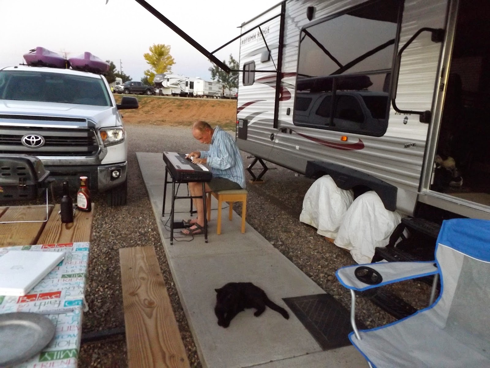 |
| Chris provides a nice after-dinner concert. I am enjoying sitting outside in the evenings to watch as the Big Dipper blinks into sight one star at a time. |
 |
| Rowdy still enjoys his time out in the fresh air. |
2 comments:
Very glad to see Rowdy still with you. He's a real survivor!
Hi Charlotte, yes, Rowdy is quite the trouper.
Post a Comment