
Sept. 7, 2014
A patch of inclement weather put a damper on anticipated activities, but as always, we found ways to keep busy. In this case, long hikes were pretty much out of the question due to rain and lightning - we were scarcely on our way hiking to Hickman Arch when it commenced to rain. It went like this: stop, don rain gear, hike some more, rain ceases, stop, shed rain gear, proceed to a high plateau, notice quickly that lightning has suddenly gotten much closer, reverse direction at a relatively high rate of speed until safely within the confines of the truck.
That was typical of our stay in Torrey where we parked to enjoy Capitol Reef National Park and more of Utah’s incredible canyon country.
Getting there . . .
As mentioned earlier, we opted out of hauling the trailer over the Escalante to Boulder to Torrey route on State Route 12 because of its very steep long grades and sharp curves and instead embarked on a longer route. The chosen track was very different from most of what is encountered in this region. The cutoff that made it possible - John Valley Road/State Route 22 from Bryce Canyon to Antimony - was populated by more bovines than vehicles; oddly, even where the range was fenced, cattle were on the road so caution was required, but visibility was excellent so it wasn’t problematic.
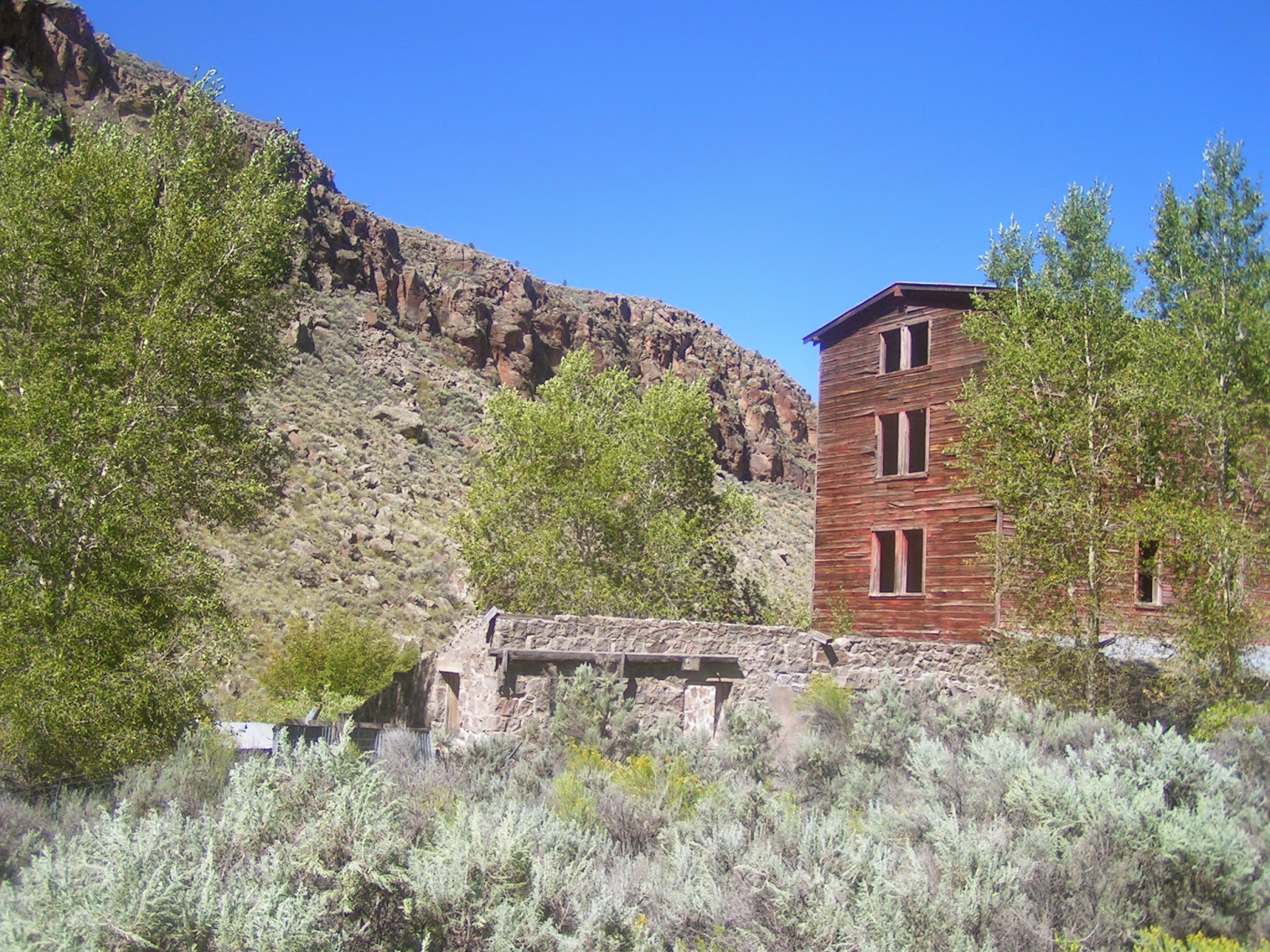
The occasional ranch headquarters could be seen at a distance; we snugged into a small pull-out at a ghost mill site that intrigued us.


Our alternate route brought us to State Route 62, along which we enjoyed the views of sage-covered slopes leading to forested mountains on both sides, and charming tiny towns with their sprinkler-irrigated farmscapes.
I could have happily spent time at numerous places along the way, and expect to do so in the future. Unlike our usual custom which is to determine a stopping place randomly as we travel, we found this Utah region’s RV parks to be relatively full, requiring reservations ahead of time; thus, we were headed for a spot saved for us in Torrey and did not tarry too much along the way.
The advantage of that method of motoring is that one gets a good overview of regions not before experienced and can get a good idea of where a return trip is warranted. Even in Torrey, our first-choice park was full; however, Wonderland is also a nice site, although not set back from the highway. Unlike the more rustic park we were at in Escalante, these are grassy sites with concrete patios. Next time, we will try Thousand Lakes.
Eagles . . .
As we motored along Highway 62, we were thrilled to see a golden eagle soar away from the pavement as we approached. To add the frosting on that cake, it was not long before that excitement turned to astonishment as we saw a bald eagle circling overhead.
Capitol Reef . . .
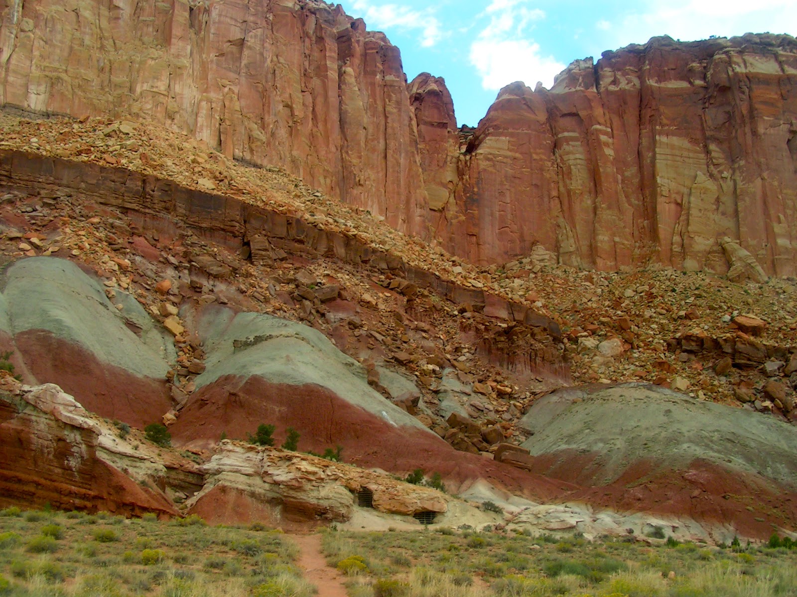
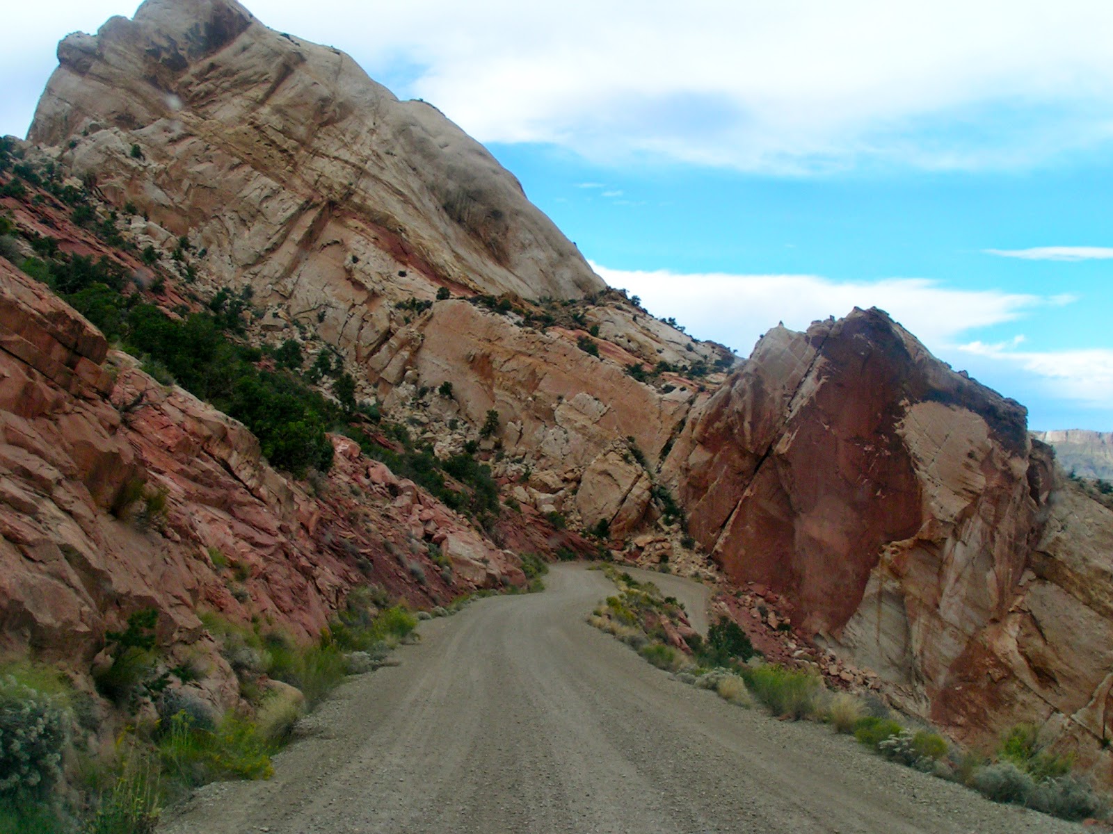
Perhaps my favorite of the national parks that I have visited, Capitol Reef offers so much to the casual tourist and trail hiker while containing vast areas for those inclined to wander the back country on foot. And best of all, it is uncrowded unlike the better known Zion and Bryce.
A person can take off hiking in any direction and have amazing adventures in that wilderness of chaotic landscape. Although precious little of that occurred this trip, still we motored through canyons that seem to be of another world and walked as much as the weather would allow.


And painting . . .
As we headed toward a hiking destination, we spotted a plein-air painter putting her version of incredible red cliffs onto canvas, so there was no choice but to find a turn-around and have a chat with the artist, Paula Swain.

Camera fiasco . . .
Chris painstakingly took apart my camera (remember, he is a handyman, after all) and managed to reposition something or other to give me a better chance at using the apparatus. Now I can vaguely view the scene that I am photographing via the screen if I take off my glasses for every shot and presuming I can shade it enough to eliminate the glare.
Because I am fairly obsessive about photographing our activities, I am happy to have that much, but frustrated because I really cannot tell what I’m doing with the lighting nor with the focus. Ah well, perhaps budget and opportunity will meet up somewhere down the road and old faithful can be replaced.
Torrey, rain . . .
We had enjoyed one previous short stay in Torrey, so were aware of how much the area has to offer. Somehow, we thought these five days would allow us to make a dent in what we want to see and do here, but such is not the case.
Without the incessant rain, it would have been some different; however, I am thinking an entire summer would be more like what is needed to begin to do justice to this region. We have outrun and outmaneuvered storms for the most part and even gotten in hikes along the way by sticking with more short jaunts instead of fewer long walks. In that way, we were able not to get caught out in precarious places during lightning storms.
Irradiating ourselves . . .
One place that got our interest was up on a slope below the cliff face where there are five mine shafts with bars placed over their openings in order to keep out those of us who choose to enter such places that may be hazardous to our health - oh, and to protect those slumbering bats that may have attached themselves to the dark overhanging ceilings within.
The Oyler mine shafts were excavated in the 1920s in a search for uranium, a mineral that can be found in some of these many layers of rock.


 |
| There's the Toter way down yonder awaiting our return. |
 |
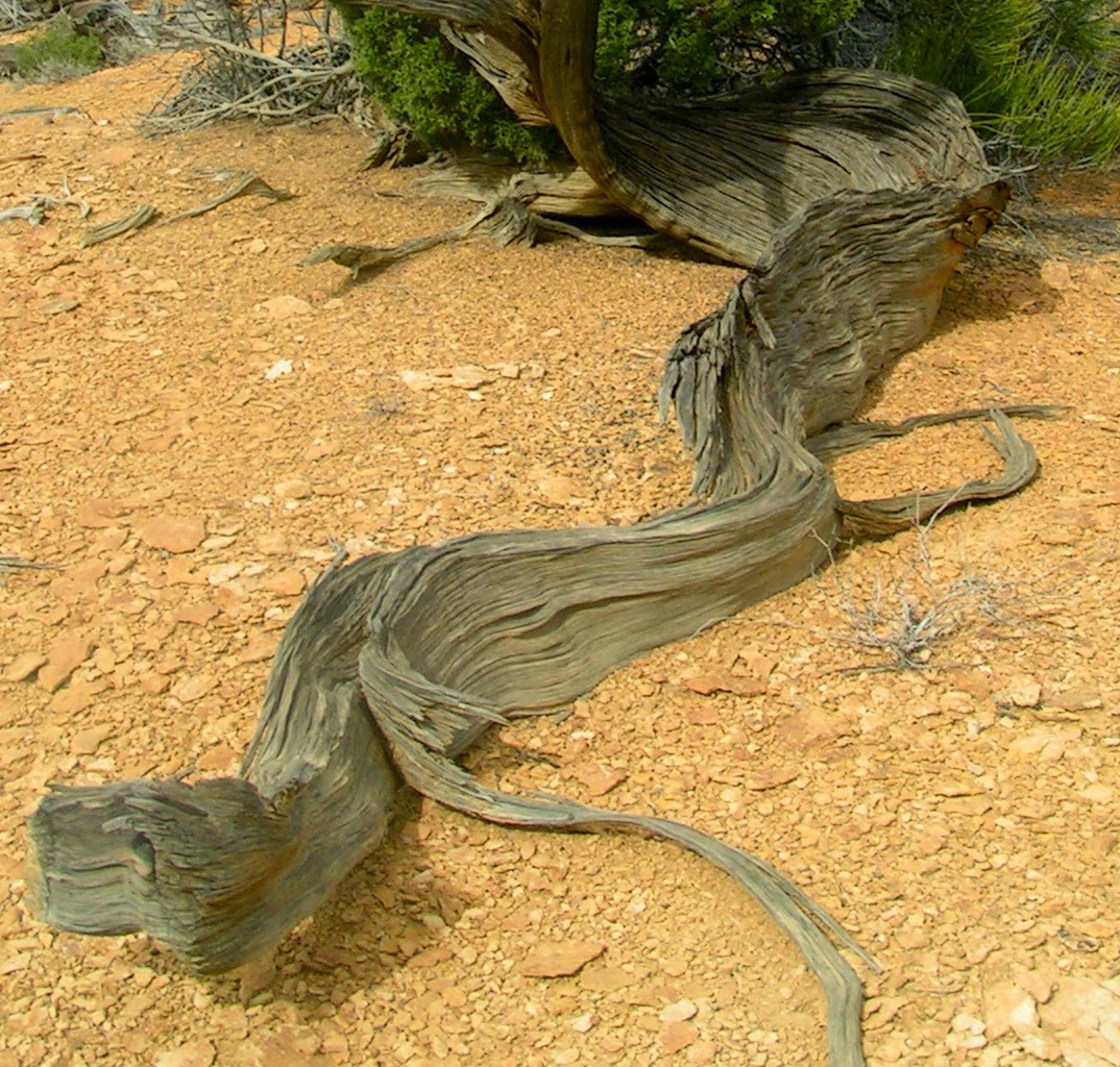
| This is the stump of a petrified tree. |
Fish Lake, Johnson Reservoir, Fremont River . . .
A day at Fish Lake some years back convinced us that we must return there, so return we did. The stunningly beautiful natural lake with crystal clear water sits at nearly 9,000 feet elevation. The day was cool and windy, unsuitable for taking the kayaks out, so we fished from shore and explored. We don’t often get non-resident fishing licenses, but this stay seemed like a perfect time for it. Unfortunately, since the dad-ratted weather prevented us from launching the boats, the little shore fishing we were able to do netted only a few small fish.


Pelicans, turkeys, farms . . .
At Johnson Reservoir, we were very surprised to find two flocks of about 15 white pelicans. Other birds we added in that country were belted kingfisher, northern harrier, California gull and northern flicker.
When we turned back, a racket across the way caught our attention and we were treated to the sight of a family squabble among wild turkeys in a field of alfalfa.
Without their noisy feud, we would never have spotted them. The binoculars gave us a view of just their heads and a bit of neck, looking for all the world like 20 question marks running back & forth above the greenery.
Old Spanish Trail . . .
It was very interesting to learn that we were on a portion of the Fish Lake cutoff of the Old Spanish Trail, a route from Santa Fe to Los Angeles historically and an area utilized also in prehistory.


In our quest to avoid storms, we enjoyed a back-country drive through Boulder and over Boulder Mountain, into another section of the Grand Staircase Monument and back into Capitol Reef.
 |
| Those are the Henry Mountains in the distance, another laccolith or lava blister, more eroded than Navajo Mountain that was formed in the same way. They were the last mountain range in the contiguous 48 states to be explored and mapped. |


We were astounded to find our route took us through The Gulch and Long Canyon, reminiscent of our hike into Escalante, except that this was a paved road twisting through the sunless bottom of towering red rock cliffs close on each side with house-size boulders fallen from the heights.
This stupendous canyon country covers so many hundreds of miles and has such diversity in shape and color that it is just not explainable. Everywhere we turn, we find ourselves exclaiming, pointing, photographing and pretty much just unable to comprehend the shifting landscape.
The switchbacks!!! . . .
Okay, we knew we had climbed a great distance and therefore would have to drop an equal distance; however, I could never have imagined anything like the Burr Trail switchbacks to accomplish the task.
By the time we reached that spot, we were on gravel road up and over the crest. When I looked down and saw what was to come, I was . . . well, let’s just say I was an unhappy camper. I managed to maintain some semblance of composure long enough to snap one photo before we proceeded down, around, down, around, down, around . . . I did not count the number of switchbacks, but I assure you it was far too many.
The way was exceedingly steep and somehow, the perspective made it look as if the road after each tight, tight turn was dropping away at an even more alarming grade than it actually was. The reality was terrifying enough; the perception was horrible! The road was so washboardy and narrow that if we had met a car coming up, I would have . . . well, heck fire, I don’t know what I would have done . . . probably begun sobbing uncontrollably.
This road made me yearn for Hell’s Backbone, a veritable superhighway in comparison.
 |
| Switchback number 1. After that, I just cringed the entire way down, racing heartbeat, sweaty palms and all. |
Fruita, pioneers . . .
We didn’t spend a lot of time in the charming historic Fruita region, only because we have done that before, but we did stop in at the U-pick orchards to try out the apples and again saw the Gifford cabin and barn and marvelled at some of the other pioneer dwellings in the area, including the Behunin cabin that inexplicably housed a family of ten, but only by sleeping the girls in the wagon bed and the boys in a dugout or rock shelter in the cliff behind.


There are numerous lakes and reservoirs hereabouts yet unexplored by us, in addition to the entirety of the Dixie and Fishlake national forests. On a previous trip, we took then-new Ruby, the Four Runner, up into the mountains on what can only be called a hiking trail (Chris was very excited about having four-wheel-drive), venturing to and fishing a couple of tiny mountain lakes, the names of which have dissipated into the fogs of memory.
This time, we ventured to the larger Lower Bowns Reservoir (I have yet to locate Upper Bowns) on yet another rain-threatening day. The cold wind and impending storm assured that we had the place to ourselves.
In the process of setting up the spotting scope better to see the avian life bobbing around out there, it gave up the ghost, much to our dismay. The scope will no longer remain attached to the tripod - thank goodness we have a lifetime guarantee from Jay's Bird Barn, not that that will help now.
New birds we added there were eared grebe and red-tailed hawk (scope not necessary for him). Other new additions to the trip list are yellow warbler, rock wren and robin.
Best business sign (painted in gigantic lettering on the side of a building in Koosharem): “No rip overalls, room for the big deep bend”. Unfortunately for anyone who was going to rush out to purchase them, I didn’t catch the brand name.
 |
| Rock is not the only thing sculpted by the wind in these parts. |

 |
| Every morning when we were in Escalante, several formations of geese flew over our trailer, proudly announcing their passage. I never tire of seeing and hearing them. |
 |
| This tree-lined road in Torrey reminded us of the olden days in Chino Valley before "progress" happened. |
 |
| The Fruita orchards are a haven for tame deer. |
 |
| Aspen at the high elevations around Fish Lake are donning their autumn hues. |
 |
| The 1912 Torrey school now serves as a bed & breakfast facility. |
 |
| These squaw berries were drying on the bush; I wonder why they had not been savored by wild game. |
 |
| No, he's not grazing nor has he fallen and can't get up. He's attempting to snag a trout from under the river bank. No, I didn't believe that he could do it, either, until I saw it for myself once. This time, there was no one lurking under there. |
No comments:
Post a Comment